What Happens When Geography and Innovation Collide
It's taken a while but the consultation into opening up the Ordnance Survey's United Kingdom mapping and geographic data is out and is no doubt being debated, looked at, discussed, pulled apart and opined on. Whilst every Ordnance Survey employee I've ever spoken to is utterly in favour of this move there's still continued resistance to openness, though the gap between the two extremes of FreeOurData and the UK Government's Cabinet Office is closing and closing fast. Of course, it doesn't help when the Ordnance Survey asserts rights over the crime maps produced by London's Metropolitan Police either.
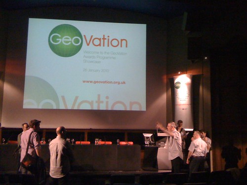
But baby steps, as my friends in the United States often say. One such step is GeoVation, a Wikiword style merging of geography and innovation.
Last year I was approached by the organisers of the GeoVation challenge to be a judge in an endeavour that "allows innovative thinkers and geographic data to come together for social, environmental and economic benefit through the use of geography". It looked like an Ordnance Survey public relations exercise to provide a seed fund to encourage entrepreneurs to use Ordnance Survey data.
1
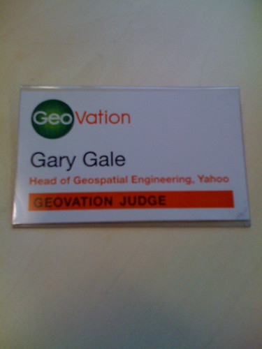
But the organisers had good credentials, I knew most of them and respected them and so I actually read the small print. Yes, GeoVation was funded and supported by the Ordnance Survey. Yes, the seed fund pot, some £20K, came from the Ordnance Survey. But using Ordnance Survey data was not obligatory, mandatory or even strongly encouraged. I heard the phrases "what about GeoNames" and "what about OpenStreetMap" enough to accept the offer and become a GeoVation judge. Not everyone thought this was a good idea or saw beyond the Ordnance Survey involvement. It wasn't just me either, I was joined by Steve Coast the founder of crowd-source mapping project, OpenStreetMap; James Alexander, CEO of Green Thing, the online service that encourages people to lead greener lives; James Cutler, CEO of eMapSite, the incredibly tall Peter ter Haar from the OS and we were helped by chairperson Steven Feldman.
There were a lot of submissions and ideas to look through. 380 people signed up, 170 ideas were submitted and almost 70 ventures were formally proposed to be entered into the award. We had some reading to do.
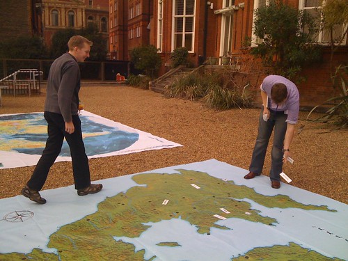
Let's briefly mention the venture submissions for a moment. They varied. Oh how they varied. It's unfortunate to say that a 15 minute video submission, a one page submission which doesn't actually tell you what the venture is and a 20 page submission which still doesn't tell you what the venture is are unlikely to engage the attention of the judges. But in the end we came up with a shortlist of 9 ventures and descended on the Ondaatje Theatre in London's Royal Geographical Society for the final showcase. Each venture had 4 minutes to pitch their idea to the judges, followed by brief questions from the judges and from the audience. It doesn't sound easy and it wasn't, but each pitch put their heart and soul into it. After all the pitches were over, the judges retired to a back room for plenty of coffee and some animated voting and discussions. After 45 minutes we emerged, blinking, into the light, still friends and still talking to each other. In first place and walking away with £10K were MaxiMap, a large scale education floor map of the British Isles which helps children understand the geography of where they live.
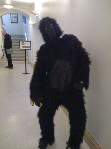
In second place, accompanied by a fetching gorilla suit, and loping away with £7K were Mission: Explore London, a team of geography addicted teachers, designers and artists who wanted to help children explore the city.
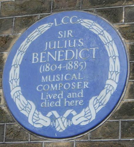
And in third place with £3K was London Blue Plaque Search, dedicated to making the iconic GLC/GLA/LCC/English Heritage blue plaques open to everyone.
After almost 6 months of meeting, discussing, debating and geopontificating GeoVation was finally over. At least for 2010. The challenge and awards will be returning in 2011 with even less Ordnance Survey involvement, though hopefully they'll still contribute towards the seed fund. And as I seem to be quoted as saying in several places ...
"One of the judges, Gary Gale, Director of Engineering for Yahoo! Geo Technologies, said: 'The standard of entries was fantastic and the scope of them far-reaching and varied. Each of the finalists can and should be proud of getting to the finals and being able to showcase their geo-vision. But in the end, the judges decided that MaxiMap was the one idea that could make the most impact and had the greatest potential.'"
... and I can't really sum it up better than that.
Photo credit: pomphorhynchus on Flickr