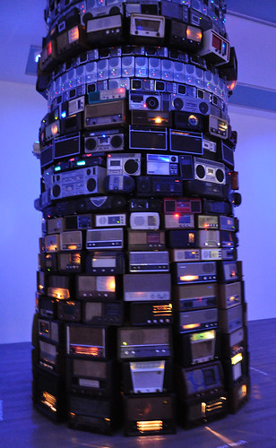
Talking GeoBabel In Three Cities (And Then Retiring It)
You're invited to speak at a conference. Great. The organisers want a talk title and abstract and they want it pretty much immediately. Not so great; mind goes blank; what shall I talk about; help! With this in mind, my first thought is normally "can I adapt, cannibalise or repurpose one of my other talks?". This sometimes works. If there's a theme which you haven't fully worked through it can serve you well.
But a conference audience is an odd beast; a percentage of which will be "the usual suspects". They've seen you talk before, maybe a few times. The usual suspects also tend to hang out on the conference Twitter back channel. Woe betide if you recycle a talk or even some slides too many times; comments such as "I'm sure I've seen that slide before" start to crop up. Far better to come up with new and fresh material each time.
But sometimes you can get away with it and so it was with my theme of GeoBabel. Three conferences: the Society of Cartographers Summer School, The Location Business Summit USA, AGI GeoCommunity 2010. Three cities: Manchester, San Jose, Stratford-upon-Avon. Three audiences: cartographers, Silicon Valley geo-location business types, UK GIS business types.
I've written about GeoBabel before; it's the problem the location industry faces as we build more and more data sets which are fundamentally incompatible with each other. This incompatibility arises either due to differing unique geographic identifiers, where Heathrow Airport, for example, is found in each data set, with differing metadata and a different identifier, or due to different licensing schemes which don't allow data to be co-mingled. We now have more geographic data than before but each data set is locked away in its own silo, either intentionally or through misguided attempts to be open.
The slide deck, embedded above, is the one I used in San Jose. The ones for Manchester and for Stratford-upon-Avon are pretty much identical but are on SlideShare as well.
As another way of illustrating the problems of GeoBabel, I came up with what I've termed The Four Horseman Of The Geopocalypse. All very fin de siecle but it seemed to be understood and liked by the audience at each talk.
The first Horseman is not Pestilence but Data Silos. All of the different types of geographic data we have, international and national commercial data, national and crowd sourced open data, specialist and niche data and social network crowd sourced data each live in isolation to each other with the only common denominator being the geo-coordinates each data set's idea of a place has.
The second Horseman is not War but Licensing. Nowadays in the Web 2.0 community we're used to having access to data but we're not willing to pay for it. Licenses vary between closed commercial licenses and open licensing. But even in the open license world there are silos, with well meaning licenses becoming viral and attaching themselves to any derived work.
Which segues neatly to the third Horseman, who's not Famine but Derivation. Each time you create something from data, you're deriving a new work in the eyes of most licenses and that means the derived work often has the original license still attached to it. You do the work, but you don't own the work.
Finally, the fourth Horseman is not Death but Co-Mingling. There is no one single authoritative geographic data set, you need to find the ones which work for you and for your business or use case. That means you need to mingle the data sets and frequently the licenses you have for those data sets explicitly prohibit this.
But now after three outings, it's time to retire GeoBabel, for now at least, just as I retired my Theory Of Stuff earlier this year. That means I had to find a new theme to talk about at my next event, the Geospatial Specialist Group at the British Computer Society. But that's in my next post.
Photo Credits: Nick. J. Webb on Flickr.
