Posts about yahoo

RIP FireEagle. You Shall Share Location No More

wrote some words that at the time seemed full of hope for the future of the Geotechnologies group I'd left.

I’ll continue to use my core set of Yahoo! products, tools and APIs … YQL, Placemaker, GeoPlanet, WOEIDs, YUI, Flickr and Delicious. Not because I used to work for Yahoo! but because they’re superb products.

Time and changes of corporate heart have not been kind here. Maybe it's time to take a look at the state of the geo union.

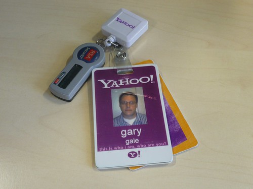
Back in 2010, when I left Yahoo! to go and join Nokia, I wrote some words that at the time seemed full of hope for the future of the Geotechnologies group I'd left.

I’ll continue to use my core set of Yahoo! products, tools and APIs … YQL, Placemaker, GeoPlanet, WOEIDs, YUI, Flickr and Delicious. Not because I used to work for Yahoo! but because they’re superb products.

Time and changes of corporate heart have not been kind here. Maybe it's time to take a look at the state of the geo union.

YQL. The Yahoo! Query Language. Still here although I haven't used it in anger for several years as the service was frequently down.

Yahoo! Maps and the Yahoo! Maps API. RIP. Yahoo! Maps is now run by the back-end services of Nokia, my current employer and the Yahoo! Maps API finally got switched off in November 2012.

Placemaker and PlaceFinder. Still here. Sort of. Placemaker is now Placespotter and while PlaceFinder keeps its name they're both part of Yahoo! BOSS Geo, which means if you want to use them it's time to dig into your wallet for your credit card as they're no longer free to use.

GeoPlanet. Still here. Still free. You have to ask the question for how long though.

WOEIDs. Still here and although you can still use WOEIDs through the GeoPlanet and Flickr APIs, the GeoPlanet Data download remains offline, although see also the fact that there's no delete button for the Internet. WOEIDs are probably not going to go anywhere soon as Yahoo's geotargeting platform depends on them. For now.

YUI. Still here and open sourced on GitHub.

Flickr. Still here, used on a regular basis by me and even flourishing with a renewed iPhone app and a horde of refugees from Instagram after that service's on, off, on again change of licensing terms in December 2012.

Delicious. Still here and still used on a relatively regular basis by me but no longer owned or operated by Yahoo! who sold it to AVOS in 2011.

Did I mention that the old Yahoo! Geo Technologies blog, after years of being down, now redirects to the Yahoo! corporate blog? No? Well it does.

And now it seems that another of Yahoo's geo products has finally done to the deadpool as FireEagle finally stops sharing people's locations and Tom Coates, who I remember discussing what would become FireEagle over coffee back when we both worked at Yahoo, was in a sanguine mood on Twitter.

Tom Coates - FireEagle

The fate of FireEagle has long been been in the balance since it was mentioned as one of the products due to be sunsetted or merged with another product in 2010. The merging never happened and now FireEagle is no more.

Which is a great shame as FireEagle was way ahead of its time and in today's age of location based services and social media sharing, the need for a way to share your location that makes sense for both the privacy of individuals and for businesses is needed more than ever.

If anyone's looking to resurrect the notion of FireEagle, hopefully you'll be the first to let me know.

A Year On And Yahoo's Maps API Finally Shuts Down

deadpool. The same applies for APIs and when they finally go offline, they usually end up in the Programmable Web deadpool.

YDN Maps Shutdown

At around 1.30 PM London time yesterday, the Yahoo! Maps API got added to the Programmable Web deadpool for good. Despite the announcement I wrote about last year that it was being shutdown on September 13, 2011, up until yesterday the API was very much alive and well and still serving up map tiles, markers and polylines via JavaScript.

Nothing on the interwebs is forever. Services start up and either become successful, get acquired or shut down. If they shut down they usually end up in TechCrunch's deadpool. The same applies for APIs and when they finally go offline, they usually end up in the Programmable Web deadpool.

YDN Maps Shutdown

At around 1.30 PM London time yesterday, the Yahoo! Maps API got added to the Programmable Web deadpool for good. Despite the announcement I wrote about last year that it was being shutdown on September 13, 2011, up until yesterday the API was very much alive and well and still serving up map tiles, markers and polylines via JavaScript.

Yesterday I was running some tests on the latest pre-release version of Mapstraction, which still supported the Yahoo! Maps API and they were running without error all morning. Then they stopped. The API just wasn't there anymore.

$ wget https://api.maps.yahoo.com/ajaxymap?v=3.8&appid=(redacted) Resolving api.maps.yahoo.com... 98.139.25.243 Connecting to api.maps.yahoo.com|98.139.25.243|:80... connected. HTTP request sent, awaiting response... 503 Service Unavailable

A quick look at the API's home on the web at developer.yahoo.com/maps/ajax/ shows an update to the previous shutting down message, with developers now being redirected to developer.here.net, the home of Nokia's new Here Maps API.

So whilst the demise of the Yahoo! Maps API in September of last year proved to be somewhat exaggerated, the plug has now been well and truly pulled.

I'll always have a soft spot for the Yahoo! API; it was the first mapping API I really cut my teeth on and while things change on the interwebs on a daily basis I can't help but feel sadly nostalgic.

This does mean that the next release of Mapstraction will no longer support the Yahoo! Maps API, though it will support Nokia Maps and Here Maps. My signed copy of Charles Freedman's Yahoo! Maps Mashups will also continue to remain on my office bookshelf as a memento.

Farewell Yahoo! Maps API, Hello Nokia Maps API

leaving Yahoo! and joining Nokia in May of 2010 I said ...

So whilst I’m going to Nokia, I’ll continue to use my core set of Yahoo! products, tools and APIs … YQL, Placemaker, GeoPlanet, WOEIDs, YUI, Flickr and Delicious. Not because I used to work for Yahoo! but because they’re superb products.

... and I meant every word of it. The Yahoo! APIs were stable, powerful and let create web experiences quickly and easily. But now a year later a lot has changed. I still use Flickr on a pretty much daily basis, but Delicious is no longer a Yahoo! property and I transitioned my other web presence from using YQL for RSS feed aggregation to use SimplePie as YQL was frequently down or just not working. The original core set of Yahoo! APIs I use in anger is now just down to Flickr and YUI.

Yahoo's JavaScript and AJAX API was the first mapping API I ever used and it now seems hard to remember when Yahoo's API offerings were the dominant player, always iterating and innovating. The Yahoo! API set formed and continued to underpin the majority of my online presence. When I wrote about leaving Yahoo! and joining Nokia in May of 2010 I said ...

So whilst I’m going to Nokia, I’ll continue to use my core set of Yahoo! products, tools and APIs … YQL, Placemaker, GeoPlanet, WOEIDs, YUI, Flickr and Delicious. Not because I used to work for Yahoo! but because they’re superb products.

... and I meant every word of it. The Yahoo! APIs were stable, powerful and let create web experiences quickly and easily. But now a year later a lot has changed. I still use Flickr on a pretty much daily basis, but Delicious is no longer a Yahoo! property and I transitioned my other web presence from using YQL for RSS feed aggregation to use SimplePie as YQL was frequently down or just not working. The original core set of Yahoo! APIs I use in anger is now just down to Flickr and YUI.

YDN Maps Shutdown

Sadly, this trend is continuing and on September 13th, to badly mangle the quote from Cypher in The Matrix, "buckle up your seatbelts Map scripters, 'cause the Yahoo! Maps API is going bye-bye" and writing ...

var map = new YMap(document.getElementById('map'));

... will be a thing of the past. Adam Duvander, author of the excellent Map Scripting 101, has written a eulogy for the Yahoo! Maps API over on Programmable Web, including some pithy quotes from old friend Tyler Bell, whom I worked with when I was part of the Yahoo! Geo Technologies group, which sadly echo my comments on the overall demise of Geo at the company.

Thankfully all is not doom and gloom in the world of mapping APIs and Nokia's Maps API is firmly in the spotlight to take up the slack left by the addition of the Yahoo! Maps API to the deadpool. And if you're using Mapstraction with the Yahoo! Maps API, it should be relatively trivial to swap your code over to the Nokia API as Mapstraction now supports Nokia Maps. I may have had a hand in that.

The Non Golden Rules of Geo (Redux)

last post, that blog is now offline, presumed dead. But one post that seems to keep catching people's imagination is the one in which I, somewhat tongue in cheek, codified the Six Non Golden Rules Of Geo. Much to my satisfaction, it keeps getting mentioned, although the full original post is inaccessible, as is the rest of that blog. Nate Kelso reproduced part of it, as did John Goodwin but until earlier today I'd not been able to find the full post.

Step forward the aforementioned John Goodwin who, with a bit of internet detective work, managed to find a mirror of the post. While I much prefer to link to blog posts rather than reproduce them in full, in this case I'm plagiarising myself and making an exception on the ground of inaccessibility, and have mirrored the post in full here. It's worth mentioning that this post was originally written in February of 2009, when I was still working for Yahoo! so it's a little out of date and was originally posted as ...

Back when I used to work for Yahoo! I wrote a lot of posts for the Geo Technologies blog; for reasons partially explained in my last post, that blog is now offline, presumed dead. But one post that seems to keep catching people's imagination is the one in which I, somewhat tongue in cheek, codified the Six Non Golden Rules Of Geo. Much to my satisfaction, it keeps getting mentioned, although the full original post is inaccessible, as is the rest of that blog. Nate Kelso reproduced part of it, as did John Goodwin but until earlier today I'd not been able to find the full post.

Step forward the aforementioned John Goodwin who, with a bit of internet detective work, managed to find a mirror of the post. While I much prefer to link to blog posts rather than reproduce them in full, in this case I'm plagiarising myself and making an exception on the ground of inaccessibility, and have mirrored the post in full here. It's worth mentioning that this post was originally written in February of 2009, when I was still working for Yahoo! so it's a little out of date and was originally posted as ...

UK Addressing, The Non Golden Rules of Geo or Help! My County Doesn’t Exist

George Bernard Shaw once said the golden rule is that there are no golden rules and at Geo Technologies we understand that there is no one golden rule for geo and so we try to capture and express the world’s geography as it is used and called by the world’s people. Despite the pronouncement on golden rules, a significant proportion of the conversations we have with people about geo lend themselves to the Six Non Golden Rules of Geo, namely that: 1. Any attempt to codify a series of geo rules into a formal, one size fits all, taxonomy will fail due to Rule 2. 2. Geo is bizarre, odd, eclectic and utterly human. 3. People will in the main agree with Rule 1 with the exception of the rules governing their own region, area or country, which they will think are perfectly logical. 4. People will, in the main, think that postal, administrative and colloquial hiearachies are one and the same thing and will overlap. 5. Taking Rule 4 into account, they will then attempt to codify a one size fits all geo taxonomy. 6. There is no Rule 6, see Rule 1.

I codified these rules after a conversation last week, via Twitter and Yahoo! Messenger, with Andrew Woods, a US based developer who was, understandably, confused by the vagaries of the how addresses work in the UK. Andrew’s blog contains the full context but it can be distilled into three key questions: * If the country is The United Kingdom, how come the ISO 3166-2 code is GB? * If the country is The United Kingdom, is England a country? * If England is a country, do I use it in an address?

As a US developer, Andrew is naturally fluent with the US style of addressing, with all of its’ localised and regional exceptions. This is a good example of both Rules 3 and 4 in the real world; most people in the US will use number, street, city, State and ZIP for specifying an address. But how does this transfer to the UK? What’s the equivalent of a State … England, Scotland or Wales? Let’s try to answer some of these problems:

Middlesex In 1824

If the country is The United Kingdom, how come the ISO 3166-2 code is GB?

The UK’s full name is The United Kingdom of Great Britain and Northern Ireland and although the United Kingdom and Great Britain are used interchangeably, Great Britain really refers to England, Scotland and Wales. At the time of writing, both GB and UK are formal ISO 3166-2 codes for the United Kingdom with GB being the assigned code for Great Britain and UK being exceptionally reserved by the United Kingdom.

If the country is The United Kingdom, is England a country?

To be formal and precise, the United Kingdom is a unitary state, not a country, with four “member” countries; England, Northern Ireland, Scotland and Wales.

If England is a country, do I use it in an address?

Normally, no. A full UK address consists of the following: * The addressee’s name, if known or applicable * The company or organisation, if known or applicable * The building name; optional if the building has a number * The number of the building and the name of the street * The locality name;optional * The Post Town * The county; optional if a Post Town and Postcode are supplied * The Postcode

… for example, take our office address of Yahoo! Geo Technologies, 125 Shaftesbury Avenue, London, WC2H 8AD. This address has no building name, a building number and street, no locality name, a Post Town, no county as we have a Post Town and a Post Code, and a Post Code.

Which brings me neatly to another example of Rule 4 and the missing county of this post’s title. The UK’s postal hierarchy and administrative hierarchy are not the same. Since 1996 the first half of a UK postcode, known as the outward code, has been used to help in the sorting of mail but prior to this a set of postal counties were used as part of addresses and these frequently do not match the current set of administrative counties. For example, the county of Middlesex was formally abolished in 1965 with the majority of the county becoming part of Greater London. Despite this and despite the 1996 postcode changes, Middlesex lives on as a postal county and as informal area name with the side effect that it is still possible to send mail, and have it delivered, to places in a county which hasn’t existed for over 40 years.

Oh, and Yahoo! GeoPlanet, naturally, recognises Middlesex and correctly identifies it as a Historical County.

The Opposite Of Geolocation Is ... Relocation?

elsewhere on this blog but this post merits another. I used to work for Yahoo! as part of the Geo Technologies group. I now work for Nokia as part of their Location group. The opinions and ideas expressed in this post are absolutely just my own, and should not be confused with, or taken for, those of my current or past employers. It's just me here.

You may not have realised it but Friday May 27th. was a sad day for the Geo industry in London. Even without the benefit of knowing what was going on from ex-colleagues inside the company, the signs were there if you knew where to look for them and how to read them.

Before the Internet, companies, teams and projects could fade quietly into anonymity and into oblivion. But on the Internet, everything is in public and it's much harder to hide the tell tale signs. API updates and bug fixes cease. A web site or blog stops being updated or goes down altogether. A Twitter feed stops being an active living thing and becomes merely a historical record. Ex-colleagues start following you on Twitter or you start getting connection requests on LinkedIn whilst other colleagues start polishing and updating their LinkedIn profiles.

And May 27th. 2011? That was the day that the last of the remaining members of my old team at Yahoo! Geo Technologies left the Yahoo! office in London and that was the day that Yahoo! ceased to have a Geo presence in the UK.

First a disclaimer; there's one elsewhere on this blog but this post merits another. I used to work for Yahoo! as part of the Geo Technologies group. I now work for Nokia as part of their Location group. The opinions and ideas expressed in this post are absolutely just my own, and should not be confused with, or taken for, those of my current or past employers. It's just me here.

You may not have realised it but Friday May 27th. was a sad day for the Geo industry in London. Even without the benefit of knowing what was going on from ex-colleagues inside the company, the signs were there if you knew where to look for them and how to read them.

Before the Internet, companies, teams and projects could fade quietly into anonymity and into oblivion. But on the Internet, everything is in public and it's much harder to hide the tell tale signs. API updates and bug fixes cease. A web site or blog stops being updated or goes down altogether. A Twitter feed stops being an active living thing and becomes merely a historical record. Ex-colleagues start following you on Twitter or you start getting connection requests on LinkedIn whilst other colleagues start polishing and updating their LinkedIn profiles.

And May 27th. 2011? That was the day that the last of the remaining members of my old team at Yahoo! Geo Technologies left the Yahoo! office in London and that was the day that Yahoo! ceased to have a Geo presence in the UK.

Sad Yahoo! Smiley

I joined Yahoo! in 2006 as Engineering Manager for Geo Location Targeting, also known as GLT (and not standing for Gay, Lesbian and Transgender, a mistake once made by someone at a conference with hilarious consequences), a group formed from the acquisition of WhereOnEarth.com a year earlier in 2005. As the name suggests, GLT was formed to use WhereOnEarth's technology to build Panama, Yahoo's geotargeting ad platform, a task which the technology was well suited to and a task at which the team succeeded.

But post Panama, we faced the challenge that most acquisitions face ... "we've done what we were acquired for ... now what"? In 2008 we started to answer the "now what?" question. With Tom Coates and the Yahoo! Brickhouse team, we provided the back-end geo platform for Fire Eagle. With Aaron Cope and Dan Catt, we provided the back-end geo platform for geotagging photos on Flickr. And with Martin Barnes, Tyler Bell and Mark Law we launched the GeoPlanet geodata gazetter API and the Placemaker geoparsing API. These were heady days for geo; GPS was reaching critical mass in consumer devices and web service mashups were ready to take advantage of powerful geo APIs and with Chris Heilmann evangelising furiously as part of YDN, the Yahoo! Developer Network, we were well placed to take the lead in the explosion of interest in all things geo that was starting then and continues to this day.

Yahoo!

Yet the company didn't seem to know what to do with their Geo Technologies group. We were reorganised more times that I can remember, starting again with another Vice President and another group. The promising lead in this area started to loose ground and the long promised investment never seemed to materialise. In May 2010, Nokia made me an offer to be part of the their location group that I couldn't refuse and I jumped ship. TechCrunch seemed to like this; twice to be exact. Over the next 12 months the group in London continued to shrink and continued to lack investment. The signs were all there for anyone to read ... the YahooGeo Twitter feed was last updated in January 2011 with a total of 5 Tweets since I handed over the reins on May 28th. 2010. The blog at www.ygeoblog.com has been down for almost a year as well.

And on Friday May 27th. 2011, the last of the London team left the office in London's Covent Garden for the final time as the Geo Technologies group transitioned and relocated to the Yahoo! corporate headquarters in Sunnyvale, California and to Bangalore; a sad day for the team in London and a sad day for the Geo industry overall. Hopefully the future will yield more developments of the YDN Geo APIs and the WOEID geoidentifier and while Geo Technologies in the company continues to live and to power the successor to the Panama geotargeting platform, the London presence where the technology grew and was developed is over.

Will The New Delicious Still Be ... Delicious?

Delicious is dead! Long live Delicious. Like a lot of Delicious users, I recently received a mail urging me to authorise the transfer of my Delicious account and bookmarks to the new service once ownership transfers from Yahoo! to AVOS.

The reception to the news of Delicious's new owners has been ... varied. Marshall Kirkpatrick has written a post in favour of the transfer, but Violet Blue is not so sure. If you do a little bit of digging, you'll see that the new Delicious has the potential to be far more restrictive on what you can, and what you can't bookmark, especially where potentially offensive content is linked to. Offensive is a horribly vague and subjective term; one which means many different things to many different people.

Delicious

At the heart of the issue is the difference in wording between the old Delicious terms ...

The linked websites’ content, business practices and privacy policies are not under the control of Delicious, and Delicious is not responsible for the content of any linked website or any link contained in a linked website. (…) In accessing Delicious or following links to third-party websites you may be exposed to content that you consider offensive or inappropriate. You agree that your only recourse is to stop using Delicious.

... and the new ones ...

You agree not to do any of the following: post, upload, publish, submit or transmit any Content that: (…) violates, or encourages any conduct that would violate, any applicable law or regulation or would give rise to civil liability; (iii) is fraudulent, false, misleading or deceptive; (iv) is defamatory, obscene, pornographic, vulgar or offensive (…)

If a complaint is made and if the new terms are upheld, you run the risk of having all your bookmarks removed, without recourse and without warning. Admittedly that's a lot of ifs.

A cursory trawl through my Delicious bookmarks doesn't seem to have anything obscene or pornographic, but there's a lot of linked content which is fictitious and could possibly be deemed misleading or deceptive. As the saying goes, you can please some people, some of the time, not all people, all of the time. When you have terms of service which are vague and ambiguous, you can rest assured that someone will exercise their right to be offended. For now, I've authorised my old Delicious account to be transferred to the new service, but I've also taken a backup, just to be on the safe side.

What's also unclear is whether the Delicious API and RSS feeds will remain; one of my web sites relies on these to dynamically update the site's content.

While Delicious lives on, whether I'll continue to be a user of the service or migrate to my own, self hosted solution, as I've already done with my URL shortener, remains to be seen. Photo Credits: Shaneblog on Flickr.

Facebook Places; Haven't We Been Here Before?

Locating The Next Role; The Yahoo! Years

this is who I am, who are you?

Some 4 years ago (actually 3 years and 10 months but let's round up for the sake of convenience) I wasn't really looking for a new role, but the opportunity arose to come and lead and engineering team for Yahoo! Now, four years later, it's time to move onto another role, but more of that in a moment.

Looking back at my career over the last 20 or so years, it's immediately apparent that it's always been a bit geo. Geophysical seismic survey processing for natural resources (OK, mostly for oil and gas) for Digicon ... geo. Setting up operations for ERS-1, the European Space Agency's first remote sensing synthetic aperture radar satellite ... geo and rocket science. Short wave radio frequency planning to enable the BBC World Service to get transmissions into countries who would much prefer the BBC didn't broadcast there ... geo. Deploying the first geo-targeted ad system and rolling out a global place based view of the world internally and to the external developer community for Yahoo! ... totally geo. Granted, there were other roles which had no geo context whatsoever but I always seem to keep coming back to this vague and nebulous mixture of place, location, maps and geography that we term geo.

this is who I am, who are you?

Some 4 years ago (actually 3 years and 10 months but let's round up for the sake of convenience) I wasn't really looking for a new role, but the opportunity arose to come and lead and engineering team for Yahoo! Now, four years later, it's time to move onto another role, but more of that in a moment.

When I announced that I was leaving Yahoo! Geo I was taken aback at the reaction that it generated. Let's rephrase that ... I was taken aback, shocked, stunned and very deeply chuffed into the bargain. Techcrunch's MG Siegler wrote about it under the brilliant headline Yahoo's Director Of Geo Engineering Locates The Exit. Numerous friends, colleagues and geo-acquaintances offered congratulations and asked where next on Twitter, on Facebook, in blog posts and by the more old fashioned method of email. I didn't expect any of this reaction, but it's that reaction that, at least in part, prompted this blog post.

By the way, you shouldn't believe everything you read in the media about working at Yahoo! It's been an amazing experience and one I would willingly repeat if I had the opportunity to go back and do it all again. Before I joined Yahoo! I thought I had a pretty good handle on how the internet worked and how web applications and APIs worked. I didn't but I did learn an awfully large amount from people do.

MacBook Pro and BlackBerry

Outside of the company, there's also a popular misconception that there's an uneasy cold war going on between Yahoo! and, in the geo space at least, their immediate competitors; Microsoft, Google, Mapquest and so on. True, there's some major cultural differences between the organisations but there's also much mutual respect for what each of our geo neighbours gets up to.

So how were the last 4 years? They went something like this ...

The Highs

The Lows

I might have already mentioned the people at Yahoo! I met and worked with. Now would be a suitable point to mention them by name ...

The Geo Technologies team, past and present: Bob Upham, Martin Barnes, Walter Andrag, Mike Dickson, Holger Dürer, Bob Craig, Roman Kirillov, Eddie Babcock, Samira Swarnkar, Rob Halliday, Rob Tyler, Chris Gent, Steve May, Ali Abtoy, Andrei Bychay, Chiho Kitahara

The YDN team: Sophie Davies-Patrick, Chris Heilmann, Anil Patel, Havi Hoffman & Stacy Millman

The Yahoo! alumni: Tyler Bell and Mark Law (ex Geo), Aaron Cope (ex Flickr), Tom Coates and Seth Fitzsimmonds (ex Brickhouse, Fire Eagle and Geo)

No Coffee Today

But now the Yahoo! years are behind me and after taking this week off to rest and do family stuff over the course of the UK Half Term school break I'll be ready to join my new team and start to get to grips with my new role as Director of Ovi Places with Nokia.

Although it would be very tempting to think that my move to Nokia is in some way a result of the recently announced partnership between Yahoo! and Nokia that's not the case. Nokia and I started the long conversation which ended with this blog post at the beginning on 2009; it took a while to get to this place.

So whilst I'm going to Nokia, I'll continue to use my core set of Yahoo! products, tools and APIs ... YQL, Placemaker, GeoPlanet, WOEIDs, YUI, Flickr and Delicious. Not because I used to work for Yahoo! but because they're superb products.

Here's looking forward to the rest of 2010; it could be geotastic.

Curiously Cartographic Creations #3 - The Special Relationship

Check. Maps of how Swedes and Hungarians see Europe? Check. Ah ... but what about how our neighbours across the Atlantic see the world? You know, the country that has a special relationship with the United Kingdom? I have just the very thing for you. Let's start with a nice simplified version of the world.

The World according to America

He may no longer be Mr. President but apparently George. W. Bush had a curious grasp of the world's geography.

The World According to Dubya

Keeping with the theme of President of the United States, this highly colourful view of the world comes from the mind of a Mr. Reagan. Allegedly.

The World According to Ronald Reagan

Photo Credits: irobot00 on Flickr.

Odd map of the London Underground? Check. Maps of how Swedes and Hungarians see Europe? Check. Ah ... but what about how our neighbours across the Atlantic see the world? You know, the country that has a special relationship with the United Kingdom? I have just the very thing for you. Let's start with a nice simplified version of the world.

The World according to America

He may no longer be Mr. President but apparently George. W. Bush had a curious grasp of the world's geography.

The World According to Dubya

Keeping with the theme of President of the United States, this highly colourful view of the world comes from the mind of a Mr. Reagan. Allegedly.

The World According to Ronald Reagan

Photo Credits: irobot00 on Flickr.

Curiously Cartographic Creations #2 - Alternative Maps Of Europe

London Underground evilly designed for tourists. In this second part of the series, it's time to cast out gaze out across the English Channel to Europe and how two of the member states see the European Union.

First there's how the Swedes see Europe; Britain is characterised by inventing soccer, inventing hooligans and beer (all three of which may be related) amongst others. The other European countries don't fare much better.

Europe according to the Swedes

Heading South and slightly East is the self styled Chosen Nation of Hungary. While the descriptions are mostly one or two words, they're not that flattering.  Britain is simply jobs, while other member states are characterised as tourist hordes, pizza, last minute hotels and beer land.

Europe according to the Hungarians

In the first of this occasional series, I looked at a curiously familiar but not quite right map of the London Underground evilly designed for tourists. In this second part of the series, it's time to cast out gaze out across the English Channel to Europe and how two of the member states see the European Union.

First there's how the Swedes see Europe; Britain is characterised by inventing soccer, inventing hooligans and beer (all three of which may be related) amongst others. The other European countries don't fare much better.

Europe according to the Swedes

Heading South and slightly East is the self styled Chosen Nation of Hungary. While the descriptions are mostly one or two words, they're not that flattering.  Britain is simply jobs, while other member states are characterised as tourist hordes, pizza, last minute hotels and beer land.

Europe according to the Hungarians

Crystal Ball Gazing Part 2 - Eddy's Sofa and The Nightmare of a Single Global Places Register

OpenGeoData, the blog and podcast on open maps, data and OpenStreetMap, a snippet of which is below.

"Eddies," said Ford, "in the space-time continuum." "Ah," nodded Arthur, "is he? Is he?" "What?" said Ford. "Er, who," said Arthur, "is Eddy, then, exactly, then?" ... Why," he said, "is there a sofa in that field?" "I told you!" shouted Ford, leaping to his feet. "Eddies in the space-time continuum!" "And this is his sofa, is it?" asked Arthur, struggling to his feet and, he hoped, though not very optimistically, to his senses.

Jump onto Eddy's sofa for a moment and fast forward to a possible 2015.

After the location wars of 2010, the problems of mutually incompatible geographic identifiers have been solved with the formation of the Global Places Register. Founded by a fledgling startup on the outskirts of Bangalore, the GPR offered an open and free way for individuals and corporations to add their town, their business, their POI. All places added became part of the Global Places Translator, allowing Yahoo's WOEIDs to be transformed into OpenStreetMap Ways, into long/lat centroids, into GeoNames ids or even, for the nostalgic, Eastings and Northings.

Sofa im Regen

... the rest of the article is on the OpenGeoData blog. Photo Credits: Hell-G on Flickr.

I recently contributed an article to the OpenGeoData, the blog and podcast on open maps, data and OpenStreetMap, a snippet of which is below.

"Eddies," said Ford, "in the space-time continuum." "Ah," nodded Arthur, "is he? Is he?" "What?" said Ford. "Er, who," said Arthur, "is Eddy, then, exactly, then?" ... Why," he said, "is there a sofa in that field?" "I told you!" shouted Ford, leaping to his feet. "Eddies in the space-time continuum!" "And this is his sofa, is it?" asked Arthur, struggling to his feet and, he hoped, though not very optimistically, to his senses.

Jump onto Eddy's sofa for a moment and fast forward to a possible 2015.

After the location wars of 2010, the problems of mutually incompatible geographic identifiers have been solved with the formation of the Global Places Register. Founded by a fledgling startup on the outskirts of Bangalore, the GPR offered an open and free way for individuals and corporations to add their town, their business, their POI. All places added became part of the Global Places Translator, allowing Yahoo's WOEIDs to be transformed into OpenStreetMap Ways, into long/lat centroids, into GeoNames ids or even, for the nostalgic, Eastings and Northings.

Sofa im Regen

... the rest of the article is on the OpenGeoData blog. Photo Credits: Hell-G on Flickr.

And In A Change To Our Scheduled Programming ...

Telematics event in Detroit in a few week's time and neither will I be at State of the Map.

The variety of reasons are both personal and based on my departure from Yahoo! at the end of this week and that the Telematics conference is coincident with my first week with [redacted]; I don't yet have a clearly articulated story with regards to [redacted] and I don't just want to retread the Yahoo! location and place story.

(untitled)

However I do plan to be speaking at the Location Business Summit USA in San Jose in September and in the same month I'll be chairing the first w3gconf in the UK. All of which provides ample scope for a modicum of geotasticness.

Photo Credits: iwasacamera on Flickr.

For a variety of reasons I'm sadly not going to be speaking at this year's Telematics event in Detroit in a few week's time and neither will I be at State of the Map.

The variety of reasons are both personal and based on my departure from Yahoo! at the end of this week and that the Telematics conference is coincident with my first week with [redacted]; I don't yet have a clearly articulated story with regards to [redacted] and I don't just want to retread the Yahoo! location and place story.

(untitled)

However I do plan to be speaking at the Location Business Summit USA in San Jose in September and in the same month I'll be chairing the first w3gconf in the UK. All of which provides ample scope for a modicum of geotasticness.

Photo Credits: iwasacamera on Flickr.

Crystal Ball Gazing Part 1 - The AGI Foresight Study

several other people with an opinion on matters geo were asked to contribute a paper towards the Association for Geographic Information's 2015 Foresight Study.

The geographic information industry is undergoing radical change. Stimulated by technology and social developments, the balance of power between existing and new players is shifting. Government policy is also undergoing transformation with the publication of the UK Location Strategy, INSPIRE, the Marine & Coastal Access Bill and a new business model for Ordnance Survey. The economic strictures under which the public and private sectors will need to operate, as the UK attempts to handle enormous public debt, are also certain to drive changes in market dynamics.

There can be little doubt that in 5 years the industry will look very different to how it does today.

As the industry association, the Association for Geographic Information (AGI) needs to be sure it can continue to deliver its central mission to serve and represent our current and future members through these changes. In order to do so, we need to better understand what these changes are likely to be and how they will impact the geospatial industry and its customers

Way, way back in the deep dark past, Autumn 2009 to be precise, myself and several other people with an opinion on matters geo were asked to contribute a paper towards the Association for Geographic Information's 2015 Foresight Study.

The geographic information industry is undergoing radical change. Stimulated by technology and social developments, the balance of power between existing and new players is shifting. Government policy is also undergoing transformation with the publication of the UK Location Strategy, INSPIRE, the Marine & Coastal Access Bill and a new business model for Ordnance Survey. The economic strictures under which the public and private sectors will need to operate, as the UK attempts to handle enormous public debt, are also certain to drive changes in market dynamics.

There can be little doubt that in 5 years the industry will look very different to how it does today.

As the industry association, the Association for Geographic Information (AGI) needs to be sure it can continue to deliver its central mission to serve and represent our current and future members through these changes. In order to do so, we need to better understand what these changes are likely to be and how they will impact the geospatial industry and its customers

Which is a nice way of saying that we were asked to look forward 5 years hence and try and predict how the UK geospatial industry would change. I had two issues with this.

Crystal Ball

Firstly, we don't have a terribly good track record for predicting how the future of a given technology will turn out ...

"There's no reason for any individual to have a computer in his home" ... Ken Olsen, founder and CEO of DEC in 1977

... and ...

"I think there is a world market for maybe 5 computers" ...Thomas Watson of IBM in 1943 (apocryphal)

Secondly, I have a slight issue with the phrase geospatial industry which, to my mind at least, conjures up images of people dealing with maps and not the geo industry as a whole, although to be fair, I'm not precisely sure what the geo industry actually covers but it's more than just maps.

Pin the Mustache on '70s Burt Reynolds - Instructions

So rather than not participating I chose to conveniently ignore the spatial specialisation an instead, attempt to play pin the tail on the (geo)donkey instead with the following paper submission:

AGI Foresight Study - Teaching Human Geography to the Internet (Gary Gale) Scribd Edit Photo Credits: pasukaru76 and archiemcphee on Flickr.

Latitude Inconsistitude

Latitude location sharing platform; there's ample coverage and commentary on ReadWriteWeb and on TechCrunch and that's just fine because that's not what I want to write about.

When it was launched in early 2009, Latitude was the receipt of some fairly harsh press from the informed tech media and from the uninformed traditional media and I argued for some latitude in the discussions on, err, Latitude.

In the midst of yesterday's I/O event, Google announced the launch of the long rumoured API for their Latitude location sharing platform; there's ample coverage and commentary on ReadWriteWeb and on TechCrunch and that's just fine because that's not what I want to write about.

When it was launched in early 2009, Latitude was the receipt of some fairly harsh press from the informed tech media and from the uninformed traditional media and I argued for some latitude in the discussions on, err, Latitude.

Latitude kept on getting compared to Yahoo's Fire Eagle and the main gripes seemed to be:

  1. Latitude is a consumer application built into Google Maps, not a platform
  2. Latitude doesn't have an API
  3. Latitide's privacy model is opt-in but all or nothing

So now Latitude has an API and everyone's happy. Right?

Unofficial Google Latitude T-Shirt

Wrong. The previous gripes have been done away with and replaced with three more gripes. 1. Latitude needs to run in the background and so will either drain battery life or won't run in the background on an iPhone at all. 2. Latitude now has granular privacy controls but these are on the back-end so Google will know your location prior to federating it to location consumers via the API. 3. Latitude needs a Google account to use.

There's a lot of inconsistency here. 1. Latitude, as part of Google Maps, already runs in the background on handsets that support that. The iPhone doesn't, yet, but that's an iPhone OS issue not a Latitude issue. Short battery life is a feature of almost all smartphone class handsets, Latitude or not. 2. Latitude gains granular privacy controls but they're on the back-end so this is a bad thing. Fire Eagle has granular privacy controls and they're on the back-end but this has never been a source of complaint. 3. Latitude needs a Google account to use. Correction. Latitude has always needed a Google account to use, so this is a bad thing. Fire Eagle has always needed a Yahoo! Id to use, and yet this is something not seen as a contentious issue.

One of the criticisms that was levelled at Fire Eagle was lack of a definitive consumer application at launch; a not unfair criticism. Latitude's taken the inverse approach, launching with a consumer application and then opening up an API almost a year later.

Time will tell which of these two location sharing platforms will dominate or whether they will be usurped by another unseen contender. Photo Credits: moleitau on Flickr.

Your Place Is Not My Place; The Perils of Disambiguation

Which Way To The Town Centre?

The hey presto bit of the process seems at first glance to be relatively trivial but isn't. Just ask anyone who's had to implement a system that handles place names. Actually, the hey presto part is actually two discreet processes in their own right. First of all we need to identify a place, or whether indeed there's a place at all; this is usually called geoidentification.

We take the art of geographic lookup for granted these days; type a place name into a form on a web site or feed it into a web service API and hey presto! Most of the time you'll be told whether or not the place name is valid or not and, in case there's more than one place with the same name, either asked to choose which one you mean or be presented with the most likely place.

Most of the time ... but not all of the time.

Which Way To The Town Centre?

The hey presto bit of the process seems at first glance to be relatively trivial but isn't. Just ask anyone who's had to implement a system that handles place names. Actually, the hey presto part is actually two discreet processes in their own right. First of all we need to identify a place, or whether indeed there's a place at all; this is usually called geoidentification.

identify; verb; establish or indicate who or what (someone or something) is

This is the thing that determines that there is a place in "I'm in London today" but not in "I do love Yorkshire Pudding".

Once a place has been identified, we need to work out if there's more than one place of the same name (which is more than likely as we're stunningly unimaginative where place names are concerned, duplicating and reusing the same name all over the world) and if so, which one. This is usually called geodisambiguation.

disambiguate; verb; remove uncertainty of meaning from (and ambiguous sentence, phrase or other linguistic unit)

Some places are pretty easy to disambiguate; as far as I know there's only one Ouagadougou and that's the capital of Burkina Faso. Some places should be easy to disambiguate, least at first sight; take London, that should be easy. It's the capital of the United Kingdom. Well that's true but it could also be the London in Ontario, or the one in Arkansas, in California, in Kentucky or any of the other 22 Londons that I'm aware of.

The gentle art of disambiguation is critical to the act of geocoding, geoparsing, geotagging and any of the other words the the location industry chooses to tack geo on as a prefix. Get disambiguation wrong and you fail on two counts.

Firstly, you're showing your audience that you don't know or don't care about what they're trying to tell you. Secondly, you allow your users the opportunity to specify the same place in a multitude of conflicting ways.

This is part of the problem of GeoBabel; your place is not my place.

So far, so theoretical, but let's look at a concrete example of this. A few weeks back I added my Twitter account to the Twitter directory site wefollow.com. The first thing you're asked to do is to supply your location, or to "Type Your City" as wefollow.com phrases it. So I type London and the site starts to attempt to disambiguate on the fly; so do I mean "London, United Kingdom" or "London, Ontario"? But wait, what about the other options?

wefollow.com - London geo disambiguation fail #1

Which "London" is the one tagged by 436 people but with no indication of which country? What's the difference between "London, United Kingdom", "London,UK" and "London England". Space and punctuation, or the lack of it, is obviously important to wefollow.com here. So let's try and give the system some help and start to type United Kingdom ...

wefollow.com - London geo disambiguation fail #2

Oh dear. The "London, United Kingdom" still shows up but because I've put a space in there I don't get offered "London,UK" anymore but I do get offered the London in the lesser known country of "Uunited Kingdom" and also "London, Ub2", which one assumes is the UB2 postal code which specifies the London suburb of Southall.

Your place is not my place.

To be fair, I'm not singling wefollow.com out for attack here; this is just one of many examples of sites who try to use geographic lookup but end up making life difficult for their users (but which London do I pick?) and for themselves (now, how many users in London in the UK do we have?). I'd happily offer to help them; if only I could find any contact information anywhere on the site ... Photo Credits: foilman on Flickr.

Geomob In A Coma

Geomob, the highly successful mobile/geo/location/place fuelled meetup for geographers, both latent and professional is on hold. Possibly permanently. As Chris Osborne, the founder and organiser, said in an email to all members of the group:

After a wonderful couple of years doing geomob, and the people powered success that was WhereCampEU, I'm afraid to say that I am stepping down to make way for some new blood.

That does mean that there is an opportunity for one or more of you to step up and continue geomob in the spirit it started - free, non corporate, disrespectful and focused on people doing things.

Get in touch if you want to take on the mantle, until then geomob is on hiatus.

Its been a blast

To paraphrase both Douglas Copland and The Smiths, Geomob, the highly successful mobile/geo/location/place fuelled meetup for geographers, both latent and professional is on hold. Possibly permanently. As Chris Osborne, the founder and organiser, said in an email to all members of the group:

After a wonderful couple of years doing geomob, and the people powered success that was WhereCampEU, I'm afraid to say that I am stepping down to make way for some new blood.

That does mean that there is an opportunity for one or more of you to step up and continue geomob in the spirit it started - free, non corporate, disrespectful and focused on people doing things.

Get in touch if you want to take on the mantle, until then geomob is on hiatus.

Its been a blast

As both Chris and I found out, organising the WhereCamp EU event that took place in London earlier this year was an exhausting, if ultimately rewarding, task. Imagine doing that every other month?

Chris Osborne at Geomob

I hope this isn't the last we hear of Geomob; it's been a major contributor to the Geo community in London and has, indeed, been a blast. It also gave me my very first Geo themed public speaking engagement and for that I'll always be both profoundly grateful and profoundly embarrased at my first stumbling efforts.

If you're thinking of taking up the role of Geomob organiser, I encourage you to do so; it's a battering, weary, exhausting and sometimes thankless task in the run up to a meetup. Then you see the audience waiting expectantly , watch the speakers, listen to the Q&A session and before you know it the evening's over in a rush; you won't regret it. Photo Credits: Roman Kirillov on Flickr.

Reaching The Limits Of Unlimited

Consider for a moment the word unlimited; it's an adjective and, if you'll pardon the condescension, it means the following:

  1. not limited; unrestricted; unconfined
  2. boundless; infinite; vast
  3. without any qualification or exception; unconditional

Except in the world of mobile data or mobile broadband, where unlimited means, in a vaguely disturbing twisted, inverted, doublespeak sort of way, the exact opposite.

Vodafone, my current UK mobile provider, helpful tells me that I have unlimited data, subject to their fair use policy which promptly redefines unlimited as very much limited indeed and your limit is 5GB per month. That's a lot of data. Even being the compulsive photo uploader, web browser, Foursquare and Gowalla check in, Twitter and Facebook poster and checker that I am, I'm hard pressed to go above 500MB per month let alone 5GB.

So I was both vastly amused and somewhat shocked when this text arrived on my iPhone on the way home from work last night.

Impossibility #1 : Reaching the limits of unlimited.

A quick call to Vodafone luckily cleared this up as being a glitch in their billing systems and I would not, as stated be charged, nor had I gotten anywhere near the 5GB limit of unlimited.

I found the whole process rather amusing in hindsight but shouldn't the mobile companies either come clean about what unlimited really means or just don't sell unlimited data as a concept at all and just sell a, 5GB in my case, data limit?

Retiring The Theory of Stuff; But First, A Corollary

Theory of Stuff out to pasture. It's had a good life. It's appeared in 5 of my talk decks (or so Spotlight tells me), in 3 of my blog posts and continues to generate hits on my blog (or so my analytics tells me).

When I tell people I'm going to talk about my theory, a Mexican wave of shoulder slumping passes through the room, coupled with a prolonged sigh from an audience who've just resigned themselves to a slow painful death over the coming minutes. Luckily things perk up when my introductory slide of Anne Elk (Miss) and her Theory appears but even so, it's time to quit whilst you're ahead.

You may well ask, Chris, what *is* my theory?

But before I do ...

It's time to put the Theory of Stuff out to pasture. It's had a good life. It's appeared in 5 of my talk decks (or so Spotlight tells me), in 3 of my blog posts and continues to generate hits on my blog (or so my analytics tells me).

When I tell people I'm going to talk about my theory, a Mexican wave of shoulder slumping passes through the room, coupled with a prolonged sigh from an audience who've just resigned themselves to a slow painful death over the coming minutes. Luckily things perk up when my introductory slide of Anne Elk (Miss) and her Theory appears but even so, it's time to quit whilst you're ahead.

You may well ask, Chris, what *is* my theory?

But before I do ...

One of the great thing's about O'Reilly's Where 2.0 conference is the vast number of people you meet who just fizz with ideas and intelligence in this somewhat nebulous space that we call location, place or geo. One such person is Sally Applin; she owns the domain sally.com so that's got her off to a good start. After Where 2.0 she pointed me to her own theory that voyeurism and narcissism sell software.

People like to look at themselves and at other people. If they can do it at the same time–then the application will succeed! Look at Facebook, LinkedIn, Twitter, MySpace, Skype–basically any software that allows for both looking at others and self viewing, self reading, self posting etc…will sell. We’re on the chimp ladder. We like to compare ourselves and compete.

If you generalise software out to the slightly more generic terms ofservice or product; you'll see that Sally's theory complements the Theory of Stuff quite nicely and even provides an exemplar of those businesses and ventures that prove the theory.

Korean unisex toilet?

This is especially interesting when you look at the success (to date at least) of ventures in the social space, such as Facebook, Twitter and Foursquare. What else are these is not an online way of saying "look at me, here I am, this is what I'm doing" and in doing so generating a vast sea of highly localised and personalised data into the bargain? Photo Credits: wili_hybrid on Flickr.

There Isn't An App For That

Want to upload photos to multiple social networking and photo sharing sites, such as Flickr and Twitpic? There's an app for that. Pixelpipe seems to work for me.

Want to update your status on multiple social networking sites, such as Twitter and Facebook? There's an app for that. Tweetdeck seems to work for me.

There's an App for (almost) everything

Want to check in to multiple place based services, such as Foursquare and Gowalla? There's an app for that. check.in seems to work for me.

Want to change your profile photo or biographical information for all of your online accounts. There's an app ... oh ... wait. There isn't an app for that. But there's a app crying out to be written.

The 3 W's of Geo (and hyperlocal deities and a pachyderm)

Jeremy Morley from the Centre for Geospatial Research at the University of Nottingham and Muki Haklay at University College London got in touch with me. The GIS Research UK Conference was in full swing, and OpenStreetMap founder Steve Coast had had to drop out of the conference due to ill health; would I think about stepping in for the closing keynote of the conference?

Hedging my bets and guessing that few, if any, of the audience had been in San Jose at Where 2.0 a couple of weeks back, I gladly accepted and reshuffled, added to and polished my Where 2.0 deck to yield Hyperlocal Deities, Pachyderms, the Letter W, the Number 3 (and some Geo).

Earlier this week, Jeremy Morley from the Centre for Geospatial Research at the University of Nottingham and Muki Haklay at University College London got in touch with me. The GIS Research UK Conference was in full swing, and OpenStreetMap founder Steve Coast had had to drop out of the conference due to ill health; would I think about stepping in for the closing keynote of the conference?

Hedging my bets and guessing that few, if any, of the audience had been in San Jose at Where 2.0 a couple of weeks back, I gladly accepted and reshuffled, added to and polished my Where 2.0 deck to yield Hyperlocal Deities, Pachyderms, the Letter W, the Number 3 (and some Geo).

The majority of the deck should be relatively self explanatory but I think it's worth calling out what I've labelled the three W's of geo ... where, when and what.

A new and accurat map of the world

The where is what we've been doing for centuries; mapping the globe. Whilst it's a sweeping generalisation, we've pretty much done this, albeit to a varying degree of accuracy, coverage and granularity. We've mapped the globe, now it's time to do something with all of this data.

Map Archaeology

The when is the gnarly problem of temporality, which just won't go away. This shows up in two ways. Firstly there's the fact that places and geography change over time; how we map a place today doesn't show how the place was 100 years ago and neither can we expect the geography of a place to be static 100 years hence. Secondly there's the problem of places which only exist at certain times of the year. Take Burning Man and Glastonbury; for most of the year these places are a salt flat in a desert and a farmer's field but at a certain time they become places in their own right.

The A13 from Ship Lane

Then finally there's the what and again, this manifests in two ways. Firstly we need to recognise that places aren't only spelt differently but they're said differently and "New Orleans" and "Noorlans" are one and the same place. Secondly a reference to a place in intrinsically bound to it's granularity. References to London from outside of the United Kingdom are frequently aimed at the non specific London bounded by the M25 orbital motorway. Zoom in and London becomes Greater London, and then the London Boroughs.

We're so close to completing the where of geo, we've only just touched on the when and the what remains uncharted territory. And that last pun was fully intentional. Photo Credits: The Norman. B. Leventhal Map Center, wokka and Thurrock Phil on Flickr.

The Long Tail; Hyperlocal or Just Hype?

ut Ubiquitous Location, The New Frontier and Hyperlocal Nirvana on Wednesday, March 31st. From doing some background research while waiting for my plane, it looks like my talk is going to be changing somewhat from the original plan. If you're going to be at Where 2.0, please pop over to the Yahoo! booth and say hello and meet the Geo Technologies and Yahoo! Developer Network teams.

The Long Tail - Review Copy

I'll be writing up a fuller version of my talk once it's complete and once it's actually written but for now, here's the published abstract.

I'm currently on my way to California, the Yahoo! mothership in Sunnyvale and the Where 2.0 conference in San Jose, where I'll be talking about Ubiquitous Location, The New Frontier and Hyperlocal Nirvana on Wednesday, March 31st. From doing some background research while waiting for my plane, it looks like my talk is going to be changing somewhat from the original plan. If you're going to be at Where 2.0, please pop over to the Yahoo! booth and say hello and meet the Geo Technologies and Yahoo! Developer Network teams.

The Long Tail - Review Copy

I'll be writing up a fuller version of my talk once it's complete and once it's actually written but for now, here's the published abstract.

The Head is all mined out; established players jealously guard their business relationships and look forward to the next contract renewal. Slightly further down the curve, the up and coming players as well as those who have slipped and fallen, eye the Head jealously and fight for scraps in the shadows. Everyone looks at the Long Tail as the new frontier.

With location-aware devices relentlessly converging, location is becoming evermore ubiquitous and is taking its rightful place as a key context to enable companies and applications to cultivate the Long Tail. Knowing local places, enriching local content, and informing local needs – anywhere and everywhere.

This talk looks at the business, social, and technological hurdles that are now being addressed or that still need to be overcome in order to reach the long-promised hyperlocal nirvana.

Photo Credits: super-structure on Flickr.

The Trinity of Geo (Both Redux and Somewhat Late)

trinity of geo was going to hit New York City. Translated, this meant that myself, Tom Coates (the man behind the creation of Fire Eagle and now roving Yahoo! Product Manager for User Location) and Aaron Cope (then chief geo wrangler and trouble maker at Flickr and now trouble maker at Stamen Design) were going to be descending on New York City for the Yahoo! Open Hack developer's conference. I also speculated that is was going to be geotastic. It was.

Ready for #openhacknyc

Now some 5 months later, the video footage that was shot in the Millennium Broadway Hotel, just off of Times Square has finally emerged blinking into the light of day so now would be a suitable time to revisit my talk, Place not Space; There's More to Geo than just Maps.

It would also be a suitable time to pair the slide deck with added video footage featuring genuine fatigue and jetlag.

Written at home (51.427051, -0.333344) and posted from the Yahoo! London office (51.5141985, -0.1292006)

In October of 2009 I wrote that the trinity of geo was going to hit New York City. Translated, this meant that myself, Tom Coates (the man behind the creation of Fire Eagle and now roving Yahoo! Product Manager for User Location) and Aaron Cope (then chief geo wrangler and trouble maker at Flickr and now trouble maker at Stamen Design) were going to be descending on New York City for the Yahoo! Open Hack developer's conference. I also speculated that is was going to be geotastic. It was.

Ready for #openhacknyc

Now some 5 months later, the video footage that was shot in the Millennium Broadway Hotel, just off of Times Square has finally emerged blinking into the light of day so now would be a suitable time to revisit my talk, Place not Space; There's More to Geo than just Maps.

It would also be a suitable time to pair the slide deck with added video footage featuring genuine fatigue and jetlag.

Written at home (51.427051, -0.333344) and posted from the Yahoo! London office (51.5141985, -0.1292006)

Mistaking the Context for the End Game

This is a post about location (for a change); but it doesn't have to be about location as it's all about mistaking a vital element for the end game itself. I should explain.

I recently got contacted by a gentleman in the US who was looking to register a lot of domain names, in a manner which recalled the rush to buy domain names in order to make a profit as the dot com boom rushed headlong to become the dot bomb bust and which resulted in the unlovely pass-time of domain squatting.

After seeing a lot of mention of location, location based services and location based mobile services in the media, the position of location based services on Gartner's most recent hype curve and seeing a lot of acquisition activity in the location space, he was looking to register domain names with LBS in them.

The reasoning went that what he termed geo domains, such as london.com and newyork.com command a high premium then, given that location's star is in the ascendent, adding the three magic letters of LBS to such domains, such as londonlbs.com or newyorklbs.com, will also command a premium, albeit a slightly lower one.

In agreement: Some macro experiments: Gummi Bears

Let me count the number of ways that this reasoning holds a degree of water, however small. We were certainly in agreement that location, geo, place and semantic understanding of these concepts, via techniques such as entity extraction, are going to be significantly important in 2010, for several reasons:

  • The economic downturn has either bottomed out (if you're cynical) or is starting a tentative upturn (if you're optimistic) and history has shown that investment starts to turn to new and promising areas in such circumstances.
  • Gartner have flagged LBMS as just cresting from the "slope of enlightenment" to the "plateau of productivity" in their last hype curve (see slide 14 of one of my recent decks), although I'd argue that Gartner should really be flagging the concept of location rather than just LB(M)S as there's far more to location than just the services that fall under the LBS or LBMS umbrella.
  • While only with 21% of total market share for mobile handsets, smartphones are benefiting from the headlong convergence of location sensor enabled devices, although the forecasts for such devices reaching critical mass in market share have so broad a range of timelines as to be pretty much useless for making any concrete projections.
  • The public's approach to location is moving away from Big Brother style hysteria and knee jerk reactions to acceptance of revealing one's location providing a suitable value proposition is made; the check-in phenenomena that is Gowalla and FourSquare are good exemplars of this in action.

Disagreement

However, let me also count the number of ways in which we differ significantly on the importance of the keywords "geo", "lbs" and "lbms" in domain names. * For the purposes of branding and marketing, a good domain name is still an essential facet of a company's digital engagement strategy. We're seeing a similar rush towards securing the right name on social networks such as Facebook and Twitter as we saw in the glory days of the .com boom, though by no means to the same degree and by no means as blindly headlong. * But for the purposes of informing the type of information a user is looking for location is a key context and not the end game in itself, indeed I'd be happy to see the LBS and LBMS acronyms go away as they focus attention far more on the technology and far less on the context, experience and results that a user craves. * A significant percentage of online users equate the browsers icon on their desktop with the internet (hence the longevity of Internet Explorer 6 as a dominant browser). In the same vein, their prime source of searching for information is frequently a search engine, which is typically their browser's home page. * People tend to use a search engine to look for information rather than by typing a domain name into their browser's address bar (which explains why one of the dominant queries that Google handles is "google" or "google.com"); the search engine is becoming the internet in much the same way as the desktop browser icon used to be "the internet". * Whilst a user may type a well known brand name into their browser's address bar, frequently without the TLD, this still equates to a search as the browser either appends .com automagically or examines the entered URL for syntax and passes it onto the user's default search engine for handling. * Again, whilst geographical keywords are much sought after for search marketing purposes and command a high bid price as a result, I've not seen any evidence, either from research or anecdotally, to show that a geographical URL has benefit in the same way. Indeed from looking at www.london.com, the site is a hotel booking aggregator, with suspect use of Transport for London's Tube roundel logo and in the small print warns "This site and domain are not affiliated with or owned by any government or municipal authority". It's not a site I've even even been aware of nor known anyone use, ditto www.sanfrancisco.com and www.sanjose.com, two cities I frequently visit both as a tourist and for business.

So while the location industry may have embraced the terms geo, location based service, location based mobile service and their acronyms, these are vague and not well known outside of the industry, which is the target demographic. I can't see a need for use of the domain name system in this way.

Location is a key context that informs the user and helps to provide relevance, it's not the end game both in function or in the names and terms that describe it. I think Ed Parsons, Google's Geotechnologist summed it up rather neatly when he recently described location as equivalent to DNS ... "normal people use it every day but they (don't have to understand it) or see it's value" and I find the comparison to DNS particularly apt in this circumstance. Photo Credits: hypercatalecta and Werner Kunz on Flickr. Written at home (51.427051, -0.333344) and posted from the Yahoo! London office (51.5141985, -0.1292006)

Thinking of Linking

Hyperlinks in the form of web links are the lifeblood of today's internet and world wide web. Examination of your web server's log files, either directly via tools such as Webalizer or indirectly via analytics services such as Yahoo's or Google's can show you who's visiting your web site or blogs.

But who's visiting your site isn't the whole picture; following a hyperlink is an active process. To complete the picture you need to find out who's linking to your site, which is a passive process.

Hyperlink

If you're running a blog you may be able to use trackbacks or pingbacks to find out when a site links to you, but only if the linking site support the trackback or pingback protocol and then only if this is enabled on both sides of the ping relationship.

So what about those sites which don't support trackbacks or pingbacks or who don't want to be discovered that they're linking to you?

That last use case may seem overly paranoid, but as Chris Heilmann recently discovered, knowing who's linking to you is less a luxury and more an essential piece of information that can reveal unwanted content placed on your server by a third party ... and third parties placing content on your server is never a good thing.

Working for Yahoo! and working with people such as Chris, who understands how the web and the net work, has taught me a massive amount over the last 4 or so years. So in this case the answer is glaringly obvious once you stop to think about it, the major source of who's linking to who is ... a search engine.

Google Reader

So now not only do I know who's visiting my sites but also who's linked to them, by using Google's Blog Search and synching that through Google Reader to NetNewsWire, my RSS reader on my laptop. The moment someone links to me and that gets picked up by Google's spider, I get an alert. Of course, this doesn't cover all eventualities but it's always a good thing to have more than one source of information, especially when that comes for free.

NetNewsWire

Written at home (51.427051, -0.333344) and posted from the Yahoo! London office (51.5141985, -0.1292006)

Posterous; Paused. Possibly Permanently?

I've never run or hosted my own search engine. I've run and hosted web servers, mail servers, proxy servers and caching servers (I'm even contemplating running my own URL shortener), but never a search engine. There was a time when I ran an enterprise instance of Alta Vista back when I coded for a living and was part of the team building Factiva.com, but that doesn't count.

If I had have run my own search engine I would have known just how important canonical URLs are and that having multiple copies of the same content hosted on different domains would cause search engines to penalise you and loose search engine ranking, fast.

Playing with Posterous

But I've never run my own search engine. So I didn't know any of this. I probably should have, but I didn't. Mea culpa.

So what has any of this to do with Posterous? I use Posterous. I like Posterous, a lot. I've written about Posterous, quite a bit. I also use Posterous to not only post to my Posterous blog but also to my own WordPress powered blog, on a domain I've owned for a goodly number of years, via Posterous's autopost function ... and which nicely and neatly produces an exemplar of how to have duplicate content hosted on multiple domains, with multiple URL addressing systems, for each and every post I produce.

How could I have not noticed this? Other people have, including Ian Delaney's excellent write up, punnily entitled Past Posterous.

Sadly, it looks like despite the ease of blogging that Posterous offers, there is such a thing as too easy and so for now, with regret, I've postponed my use of Posterous, possibly in permanence. Unless of course, they offer a way of specifying canonical URLs.

And with profuse apologies for the overuse of alliteration in this post.

Photo Credit: I Bought a Mac on Flickr. Written at home (51.427051, -0.333344) and posted from the Yahoo! London office (51.5141985, -0.1292006)

Winter, Followed by Spring and Back to Winter Again

Four Seasons in One Day could have been written with this weekend's weather in mind. We started with Winter (cold, wet, miserably damp), followed by Spring (heavy showers, glorious sunshine and the odd rainbow or two), followed by Summer (clear blue skies).

Centre Point against an (almost) Spring sky

I've never been a massive fan of Crowded House but 1991's Four Seasons in One Day could have been written with this weekend's weather in mind. We started with Winter (cold, wet, miserably damp), followed by Spring (heavy showers, glorious sunshine and the odd rainbow or two), followed by Summer (clear blue skies).

Centre Point against an (almost) Spring sky

Then this morning, we returned back to Winter again, complete with breath misting in front of your face, frozen puddles on the station platform and people ignoring the frozen puddles and ending up resplendently sprawled on the platform.

Winter returns to the morning commute.

Blogging about the weather ... how very English.

Written and posted from the Yahoo! London office (51.5141985, -0.1292006)

Mashup, Location and London

LBi in the old Truman Brewery on London's Brick Lane for Mashup's Location ... It's Moving On. I've spoken at a Mashup event once or twice before but this time the organising team threw caution to the wind and asked me to chair the panel discussion.

Prior to kicking the panel discussion off, I attempted to gently suggest some topics to my fellow panelists that we might want to discuss.

We started off with a quick review of my Theory of Stuff and how it applies to deriving value from location and location data and briefly visited Gartner's hype curve which puts location based services on the so called Plateau of Productivity. This is a good thing apparently. I then presented the panel with a series of  "yes, but" style trade offs to mull over. * Smartphones vs. other phones; 21% of phones expected to have GPS by EOY 2009, but what about the other 79% without? * LBS and LBMS vs. other (older) location systems (APIs and so on); LBS and LBS apps get all the publicity but what about key location APIs, platforms and services? * "where's my friends" vs. creating value and creating data; "where's my friends" doesn't work as a (sole) business proposition but creating value added data does -- FourSquare and Gowalla are creating geotagged local business listings from check ins. * "where's my business" vs. location based advertising; Tesco and Starbucks are the latest companies to launch apps to drive customers to their premises, but what's needed to drive location based ads? * "where I think you are" vs. "where I say I am"; For a user, being able to be their own source of truth is imperative, but how can you reconcile this with your business needs? * "where you are" vs. "where you've been"; (AKA tracking vs. privacy) How to walk the fine line between providing enhanced relevance via a user's location and being accused of tracking them.

Last night I was at LBi in the old Truman Brewery on London's Brick Lane for Mashup's Location ... It's Moving On. I've spoken at a Mashup event once or twice before but this time the organising team threw caution to the wind and asked me to chair the panel discussion.

Prior to kicking the panel discussion off, I attempted to gently suggest some topics to my fellow panelists that we might want to discuss.

We started off with a quick review of my Theory of Stuff and how it applies to deriving value from location and location data and briefly visited Gartner's hype curve which puts location based services on the so called Plateau of Productivity. This is a good thing apparently. I then presented the panel with a series of  "yes, but" style trade offs to mull over. * Smartphones vs. other phones; 21% of phones expected to have GPS by EOY 2009, but what about the other 79% without? * LBS and LBMS vs. other (older) location systems (APIs and so on); LBS and LBS apps get all the publicity but what about key location APIs, platforms and services? * "where's my friends" vs. creating value and creating data; "where's my friends" doesn't work as a (sole) business proposition but creating value added data does -- FourSquare and Gowalla are creating geotagged local business listings from check ins. * "where's my business" vs. location based advertising; Tesco and Starbucks are the latest companies to launch apps to drive customers to their premises, but what's needed to drive location based ads? * "where I think you are" vs. "where I say I am"; For a user, being able to be their own source of truth is imperative, but how can you reconcile this with your business needs? * "where you are" vs. "where you've been"; (AKA tracking vs. privacy) How to walk the fine line between providing enhanced relevance via a user's location and being accused of tracking them.

I was then joined by Chris Osborne (#geomob and Ito World), Alex Housely (Rummble), Jon Fisher (Vodafone), David Glennie (MIG) and Alan Patrick (Broadsight) for an hour's worth of lively, animated, opinionated and occasionally profane panel discussion, making the job of ring-mastering all the more challenging and a whole lot of fun at the same time.

The #mashupevent audience look on from the bowels of Brick Lane

The audience chimed in with a variety of questions, some pointed, some speculative and some downright rambling before we retired to the bar and then out to sample one of Brick Lane's finest curry houses; it's a shame we didn't find one of the finest but a decent post event wind down took place anyway in the basement of an establishment which had "Spice" in the name. I think.

All in all, a geotastic evening all round.

Written and posted from the Yahoo! London office (51.5141985, -0.1292006) Update: 1 March 2010


It seems that the topic of the Mashup* event and the buzz of publicity that the team created on social media streams, including Twitter, were sufficient to get my introductory deck onto the Featured Presentations & Documents section of the SlideShare home page.

SlideShare Home Page Updated and posted from the Yahoo! London office (51.5141985, -0.1292006)

Location is a Key Context, But Most People Don't Know This

Like a lot of people, I get most of the information I use, both personally and professionally, from the web; from RSS feeds, from keyword search alerts and from Twitter. The genesis of my recent Theory of Stuff slowly accumulated out of this mishmash of feeds, alerts and status updates.Firstly I read about EchoEcho, a new location based service which promises all manner of good stuff by showing you where your friends are regardless of which location based service they currently use. Let's leave aside for one moment that the service independence of this app seems to be based around the concept of getting all your friends to use EchoEcho and then consistently getting them to report their location. Let's look at something far more fundamental than that, the strong sense of location deja vu harking back over two years ago. Haven't we been here before?

Hindsight seems to have proven that concepts such as "who's nearby" and "show me where my friends are" aren't, on their own, enough to build a business around. The brief flare of enthusiasm over services which tried this approach such as PlayTxt and DodgeBall were soon extinguished as users, fickle as they are, got bored and moved onto the next big thing.Then there were two articles looking at "checking in", both looking at FourSquare and Gowalla but each one coming at it from wildly differing ends of the experience. On the one hand, there was Business Week quoting the eye watering "I don't feel complete unless I check in" from FourSquare, Gowalla and Yelp addict Diane Bisgeier. Though the article focuses on this as a San Francisco and the Bay Area phenomenon, this has crossed the Atlantic with vigorous checking in going on in the UK and in mainland Europe. I may even have contributed to this, from time to time.A totally contrasting view was shown by Andrew Hyde who was fed up of "the needless ego boost" of saying where he was and "committed location based suicide" by deleting his accounts from FourSquare and Gowalla. We'll leave to one side the irony that this was done very publicly and with an accompanying blog post.All of the above moved Thierry Gregorius to lament that "if 'normal' people don't see the point of location-based services, how can the geo-industry claim being mainstream?". A valid point but one which confuses the very visible front end view of location, as seen in LBMS and the less visible back end view of location. Ed Parsons summed this up succinctly by comparing back end location with the DNS system, which "normal people don't see the value of but use every day".It was these three themes, "who's nearby" as a raison d'etre alone, maintaining an audience by check-ins alone and selling location based services to a wide audience that made me sit down and write up my Theory of Stuff. The full text of this is in a previous post, but the short version of the theory states that in order for a business to succeed you need three things, some Stuff, be it data, inventory or something else, some People, your audience and some Secret Sauce which allows you to connect the audience to the stuff in a bidirectional manner. So how do these three themes fare against the theory of stuff? Surprisingly and thankfully, they all seem to validate it.The concepts of "who's nearby" and "where are my friends" on their own, fail the theory of stuff. You have People, and in some cases a very large and quickly growing audience. You have some Secret Sauce which connects those People via their locations. But because there's no Stuff to start with and the secret sauce isn't bidirectional, no Stuff is created. The effect of this is that monetization opportunities are non existent or severely limited and the service isn't sustainable. Both PlayText and DodgeBall are no more and the omens aren't looking good for EchoEcho as a result.Then there's FourSquare and Gowalla, both of whom seem to have been inspired by Google. Cast your mind back to when Google announced the concept of Street View which was met with sneers and derision from some. Before Street View even went live it was written off as a loss leader, a waste of time and money and it would be Google's white elephant.Others of us in the location industry took one look at a Street View car and noted that the cameras weren't just pointing parallel to the road surface to take photos of surrounding buildings. They were also pointing at the road and up at the road signage which, when combined with the fact that the (GPS, cell tower and wifi triangulation equipped) StreetView cars actually had to drive down the streets in question, would provide Google with their own mapping data that was also capable of powering routing and direction algorithms. A short while later and Google completes enough of North America to remove the need for TeleAtlas mapping data and makes massive savings on data licensing into the bargain.Street View passes the Theory of Stuff by providing new Stuff to be connected and monetized by their existing Secret Sauce and the People who make up their substantial audience.It would be easy to dismiss FourSquare and Gowalla as more up to date versions of the "where are my friends" service. While they seem to have created the current cultural phenomenon of checking in, which may well be their lasting legacy, both services have their own quirks (FourSquare's Mayors and Badges and Gowalla's items) and need to show they're capable of holding onto their existing audience and growing it, substantially. So this surely means that both FourSquare and Gowalla fail the Theory of Stuff? Not necessarily. Just as StreetView generated valuable Stuff for Google, so both FourSquare and Gowalla are also generating a detailed set of local business listings and points of interest, all of them neatly categorised and geotagged as a bonus. That's a lot of very valuable Stuff. This doesn't seem to have been something that's been noticed or commented on as much as it should be. If both these services can retain their audience and if they connect them with all the Stuff that is being captured and generated via Secret Sauce then they can most definitely pass the Theory of Stuff.The idea that location is analogous to the Domain Name System is slightly more challenging to fit into the Theory of Stuff's model but it's still possible.In the previous two themes, location has been the dominant factor in the provision of a service (PlayText, Dodgeball, FourSquare and Gowalla) or location data has been generated in order to create Stuff (FourSquare and Gowalla). In the DNS theme, location is not the prime reason for a service to exist, it's a context, part of the Secret Sauce, that helps the service provide its users with relevant information. This was highlighted by Kevin Marks and JP Rangaswami in last year's excellent The Impact of Context on the Mobile User Experience discussion at the Heroes of the Mobile Screen conference in London. Of course, you still need Stuff and People in order for this to work; Secret Sauce on its own is not a recipe for success.As nomadic devices have proliferated, the difference between The Web and The Mobile Web have vanished; it's just the web, regardless of how you experience it. A parallel can be drawn here with location. As location becomes more and more ubiquitous so the whole concept of a Location Based (Mobile) Service will also vanish, at least as a label. Location will just be a context. And there's nothing wrong with that; quite the reverse, as the location industry will have achieved their aim of ubiquity, of providing a service and information that everyone uses but which no one actually bothers to think about it being there.Photo Credits: Angelskdpstyles and leff on FlickrWritten and posted from  Yahoo! campus, Sunnyvale, California (51.5143913, -0.1287317) Posted via email from Gary's Posterous

Deliciousness: typography, bad days, Victoria & Albert geo, inappropriateness for children and Dave

Deliciousness. This needs to be remedied.* I don't usually take note of typography and font related stuff that much (leaving that to Tom Coates who oozes typography enthusiasm and love) but this post, on revisiting the font stack your blog or web site is essential reading. * I didn't have a good day earlier this week. Someone else felt the same way. * The Victoria & Albert Museum in Londonreleased an "Finding Places" API which allows you to discover places in their collections database. * Difficult to tell whether this is real or not, but Inappropriate Stuff for Kids is possessed of a heavy mix of LOL/OMG/WTF-ness. * Dave is popular; 9/10 real women prefer him. Lucky Dave. * "No wireless. Less space than a Nomad. Lame". In all the furore surrounding the iPad, it's easy to overlook the less than stellar reception the first iPod had. We should do this again. Soon.
Written and posted from the Yahoo! campus, Sunnyvale, California (51.5143913, -0.1287317) Posted via email from Gary's Posterous

I have been remiss; it's been over 3 months since my last Deliciousness. This needs to be remedied.* I don't usually take note of typography and font related stuff that much (leaving that to Tom Coates who oozes typography enthusiasm and love) but this post, on revisiting the font stack your blog or web site is essential reading. * I didn't have a good day earlier this week. Someone else felt the same way. * The Victoria & Albert Museum in Londonreleased an "Finding Places" API which allows you to discover places in their collections database. * Difficult to tell whether this is real or not, but Inappropriate Stuff for Kids is possessed of a heavy mix of LOL/OMG/WTF-ness. * Dave is popular; 9/10 real women prefer him. Lucky Dave. * "No wireless. Less space than a Nomad. Lame". In all the furore surrounding the iPad, it's easy to overlook the less than stellar reception the first iPod had. We should do this again. Soon.
Written and posted from the Yahoo! campus, Sunnyvale, California (51.5143913, -0.1287317) Posted via email from Gary's Posterous

Through the Window

Google-plex, west of here is the Yahoo! mothership, which is the reason I'm here and to the south is Cupertino, and 1 Infinite Loop, the home of Apple.OK, so that is fairly uninspiring and nondescript. This one is much more interesting. This is the view from my temporary cube in the middle of the Yahoo! campus, looking out over Moffett Field.That oval looking building in the middle is Hanger One which is one of the world's largest freestanding structures. It may not look that impressive but it's almost 3 miles away; it covers 8 acres, is around 1100 feet long, around 300 feet wide and around 200 feet high. It's big.And that's a much more impressive and interesting view out of the window.
Written and posted from the Yahoo! campus, Sunnyvale, California (51.5143913, -0.1287317) Posted via email from Gary's Posterous

Looking out of my hotel window I can see into the heart of Silicon Valley in Sunnyvale. What do you mean it's fairly uninspiring? East of here is Mountain View, home of the Google-plex, west of here is the Yahoo! mothership, which is the reason I'm here and to the south is Cupertino, and 1 Infinite Loop, the home of Apple.OK, so that is fairly uninspiring and nondescript. This one is much more interesting. This is the view from my temporary cube in the middle of the Yahoo! campus, looking out over Moffett Field.That oval looking building in the middle is Hanger One which is one of the world's largest freestanding structures. It may not look that impressive but it's almost 3 miles away; it covers 8 acres, is around 1100 feet long, around 300 feet wide and around 200 feet high. It's big.And that's a much more impressive and interesting view out of the window.
Written and posted from the Yahoo! campus, Sunnyvale, California (51.5143913, -0.1287317) Posted via email from Gary's Posterous

No Comment?

Location Privacy Issue? I See No Location Privacy Issue

Telematics, the use of GPS and mobile technology within the automotive business, and the Web 2.0, neo and paleo aspects of location have traditionally carved parallel paths, always looking at if they would converge but somehow never quite making enough contact to cross over.But not any more.The combination of 3G mobile communications and GPS enabled smart-phones such as the iPhone and the BlackBerry means that one way or another, the Internet and the Web are coming into the car, either in your pocket or into the car itself.

Telematics, the use of GPS and mobile technology within the automotive business, and the Web 2.0, neo and paleo aspects of location have traditionally carved parallel paths, always looking at if they would converge but somehow never quite making enough contact to cross over.But not any more.The combination of 3G mobile communications and GPS enabled smart-phones such as the iPhone and the BlackBerry means that one way or another, the Internet and the Web are coming into the car, either in your pocket or into the car itself.

With this in mind, last week I was at the Telematics Munich 2009 conference, which was coincidentally in Munich, giving a talk on some of the challenges we face with location and how the world of telematics can benefit by starting to look at location technologies on the Web.One of the sessions I sat in on prior to my talk was on the eCall initiative. This is a pan European project to help motorists involved in a collision. A combination of onboard sensors, a GPS unit and a cellular unit detect when an accident has occured and sends this information to the local emergency services. The idea is that in circumstances where a vehicle's occupants are unable to call for help, the car can do it for them.So far, so public spirited and well meaning. But several things immediately stood out.Firstly, while pitched as a pan European initiative, each member state has an opt out and naturally not all states have signed up to the initiative, including the United Kingdom.Secondly, eCall is designed to be a secure black box system, but all the talk in Munich was of "monetize eCall offerings by integrating contactless card transactions like road-tolling, eco-tax and easy parking payment" or "how to geo-locate data messages to offer ubiquitous solutions". In other words, adding value added services on top of a system which is actively able to track you at all times and which you, as the vehicle owner, has limited access to or control over.But what really stood out was that there was not a single mention of location tracking and of the privacy aspects that this carries with it. Not a single mention. Not from the panel, not from the chair and not from the audience. Once rolled out, eCall as currently designed is pretty much mandatory in all new vehicles. Compare and contrast this with the outraged Daily Mail style diatribe that other, opt in, systems such as Yahoo's Fire Eagle and Google's Latitude have attracted.The convergence of the internet, the web and telematics hasn't yet happened but it will. It's also evident that when this happens, the telematics industry may have a painful awakening as the impact of location technologies and the privacy issues they carry pervade into an industry which hasn't needed to deal with this historically. Posted via email from Gary's Posterous

The (Geo) Data Dichotomy Dilemma

FreeOurData.org.uk and other pleas, before the Internet itself, things used to be so much simpler for geo data. You were either an end user and accessed the data as a map or you were a GIS Professional and accessed the data via a (frequently very expensive and very specialised) Geographical Information System. But now we have geo data, lots of geo data, some of it free, some of it far from free, both in terms of usage and cost and a fundamental problem has replaced the paucity of data.

Everyone wants free, open, high quality geo data and no one wants to pay for it. But it's not quite that simple. The recent acquisitions of Tele Atlas and Navteq, the two big global geo data providers, by TomTom and Nokia respectively show the inherent value in owning data. But owning the data isn't enough any more as the market for licensing the data is a shrinking one, despite the phenomenal growth of the satnav market, both in car and on mobile handsets. Why is the market shrinking? Because no one wants to pay for it, at least directly. TomTom, primarily a hardware vendor, are differentiating into the software and data market,  seems to be concentrating on the PND usage of the data, although we've yet to see how the outlay necessary to acquire Tele Atlas coupled with the overall economic downturn will effect their overall 2009 earnings. Their Q1 2009 report somewhat dryly notes that "market conditions were challenging" and that "we are making clear progress with the transformation of Tele Atlas into a focused business to business digital content and services production company". There may be other aspirations at play here but for now at least, the company is keeping quiet.

Before Web 2.0, before mashups, before FreeOurData.org.uk and other pleas, before the Internet itself, things used to be so much simpler for geo data. You were either an end user and accessed the data as a map or you were a GIS Professional and accessed the data via a (frequently very expensive and very specialised) Geographical Information System. But now we have geo data, lots of geo data, some of it free, some of it far from free, both in terms of usage and cost and a fundamental problem has replaced the paucity of data.

Everyone wants free, open, high quality geo data and no one wants to pay for it. But it's not quite that simple. The recent acquisitions of Tele Atlas and Navteq, the two big global geo data providers, by TomTom and Nokia respectively show the inherent value in owning data. But owning the data isn't enough any more as the market for licensing the data is a shrinking one, despite the phenomenal growth of the satnav market, both in car and on mobile handsets. Why is the market shrinking? Because no one wants to pay for it, at least directly. TomTom, primarily a hardware vendor, are differentiating into the software and data market,  seems to be concentrating on the PND usage of the data, although we've yet to see how the outlay necessary to acquire Tele Atlas coupled with the overall economic downturn will effect their overall 2009 earnings. Their Q1 2009 report somewhat dryly notes that "market conditions were challenging" and that "we are making clear progress with the transformation of Tele Atlas into a focused business to business digital content and services production company". There may be other aspirations at play here but for now at least, the company is keeping quiet.

Nokia, also primarily a hardware vendor in the form of mobile and cellular handsets, are also moving away from their roots and into a wider market, hopefully in an attempt to stop the encroachment of upstarts such as HTC, Apple and RIM into Nokia's traditionally strong smartphone heartland. Again, Nokia has yet to make a public play into this arena but all the composite elements are in place to enable this to happen. Taking the opposite route, Google, which started off as a software player are now moving to being a player in the data market by gathering high quality geo and mapping data under the smokescreen of gathering Street View. This has allowed them to gather sufficient data to supplant Tele Atlas as a data provider, at least in the Continental United States. All three companies are either making or have the prospect of making determined plays in the location space but all three of them have ways of leveraging the value inherent in their data. Google has their unique users, their search index and a vast amount of advertising inventory; TomTom their satnav customers; Nokia their handset customers, albeit one level removed with the Mobile Network Operators as an uneasy partner and intermediary. So what of the open data providers? It's important to remember here that open doesn't always mean free, it means the ability to create derived works and to use the data in ways that the originator may not have immediately foreseen. True, a lot of open data is free, but even then it's the Free Software Foundation's definition of the word. "Free (software) is a matter of liberty, not price. To understand the concept, you should think of free as in free speech, not as in free beer." The poster child of open geo data is OpenStreetMap, the "free editable map of the world". Founded in 2004 by Steve Coast, OSM has enjoyed phenomenal growth in users and in contributions of data that can be used anywhere and by anyone and which espouses the values of free as in speech and as in beer. As with all community or crowd sourced collaborative projects, OSM's challenge is to sustain that growth and once complete coverage of a region is reached, in keeping that coverage fresh, current and valid. We'll leave aside that fact that complete coverage is an extremely subjective concept and means many things to many people. Traditionally strongest in urban regions, one of OSM's other key challenges is to match the expectations of their user community who consume that data rather than those who create it. Both internationalisation of the data and expansion out of the urban conurbations will potentially prove challenging in the years to come. That's not to say OSM isn't a significant player in this space and the quality of the data, though varying and in some places duplicated, is for the majority of use cases, good enough. This was backed up by research undertaken by Muki Haklay of UCL which answered the perennial question of "how good is OSM data" with a pithy "good enough". Attempts to capitalise on and monetize the success and data corpus of OSM through the Venture Capital funded Cloudmade have yet to deliver on the promise and with the exception of a set of APIs, Cloudmade has announced the loss of their OpenStreetMap Community Ambassadors and the closure of their London office. All of which lends credence to the fact that simply owning the data isn't enough. So how to solve the dichotomy of geo data? Everyone wants it but no one's willing to pay for it with the exception of the big players, the Googles, the Yahoos and the Microsofts of the world and control of the proprietary data sources has centralised into TomTom and Nokia, both of whom are well placed to capitalise on their data assets but who haven't yet delivered on that promise. Maybe the answer is twofold. Firstly develop an open attribution model whereby the provenance of an atom of data can be tagged and preserved; this would remove a lot of the prohibitions on creating derived works at the original data provenance could still be maintained. Secondly allow limited usage of proprietary data at varying levels of granularity, accuracy and currency, thus creating a freemium model for the data and stimulate developer involvement in donating data to the community as a whole. It's too early to see whether this will come to pass or whether an already tight hold on the data will become tighter still.

Posted via email from Gary's Posterous

Have You Noticed That noticin.gs Have Noticed WOEIDs?

While everyone, well almost everyone, was fast asleep in London, Twitter quietly dropped a bomb-shell into their API announcements mailing list. Their new Trends API will help the service's users answer the perennial question "what's going on where am I".

So far, so geo but Twitter has noticed what I've been saying in my talks and accompanying decks for the last two years or so. "We're using Yahoo!'s Where on Earth IDs (WOEIDs) to name each location that we have information for -- we're doing so because those IDs give not only language-agnostic, but also permanent, stable, and unique identifiers for geographic locations.  For example, San Francisco has a permanent and unique WOEID of 2487956, London has 44418, and the Earth has WOEID 1."

Whilst there have been other uses of WOEIDs in the wild, including Alex Housley's Total Hotspots, Twitter picking on WOEIDs rather than another of the competing geo-identifiers is a massive credibility boost for the WOEID as a geographic standard for identifying and describing place. Using WOEIDs to geotag your content, be it Twitter status messages, blog posts or photos, automagically gives you access to an ever increasing range of data and web services that understand WOEIDs as well as those that still only understand longitude and latitude. Long/lat coordinates are an attribute of WOEIDs in case you were wondering. Proof of this is visible in the elegant and oddly addictive game of Noticings. Noticings is "a game of noticing things about you" jointly created by Tom Taylor. Tom was responsible for Boundaries, the amazing visualisation of Aaron Cope's Flickr Alpha shapes which allows geographies, such neighbourhoods, for which no formal definition exists, to be represented and viewed. Basically you tag Flickr photos with the "noticings" tag and the photo's location, either from an onboard GPS or on Flickr and then you score points for your photo of something you noticed. Which doesn't do it justice. The rules are in a constant state of flux but all to the better making it a Mornington Crescent for geotagged photos. Using WOEIDs as a stable and consistent geoidentifier is the glue that allows such a super-web-mash-up to be created. Flickr uses WOEIDs as a geotagging mechanism, either from the EXIF data embedded in a photo or by dragging and dropping the photo on a Map; these WOEIDs are then exposed via the Flickr API. The same Flickr API can be used to look for photos meeting certain criteria, such as the noticings tag and to discover photos taken in the same location, a fundamental part of Noticings. As Tom puts it ...

"(WOEIDs and GeoPlanet) gives us the opportunity to use colloquial geography rather than bounding boxes and radial searches and the like. I banged on about this in my talk at the AGI conference recently. I am such a geography bore. Anyway, we couldn’t have built Noticings without it."

For those who like the technical gory details, Tom's put up an excellent blog post to explain it all.

But it doesn't stop at photos and Flickr, once you have a WOEID you can pass it to any of the ever growing number of web APIs that know how to handle WOEIDs, Yahoo's GeoPlanet, Placemaker, Fire Eagle, YQL as well as services that speak long/lat. That's a lot of services, and the number's growing. Plus you get access to the horizontal and vertical relationships, parents, children and neighbours that a WOEID has as well as more obtuse colloquial geographies, all in multiple languages.

All of which is somewhat apt as I'm writing this in Munich at the back of the Telematics 2009 conference. While Munich is fine for the English speaking world, it's München in Germany and Monaco di Baviera to the Italians. But it may also be spelt as Muenchen and Munchen if special characters or accents aren't used. All of these names are simply multiple versions of the same place, and so are mapped to a single WOEID, 676757. Now go and notice something.

Posted via email from Gary's Posterous

NYC Beware : The Trinity of Geo Is Coming

I've never been publicly seen in the same room as Aaron Cope and Tom Coates before.

Ever noticed how you never see some people in the same room together? Various conspiracy theories abound on this theme; that they're really the same person or that they're mortal enemies. All complete rubbish of course but maybe there's some truth in this after all ... I've never been publicly seen in the same room as Aaron Cope and Tom Coates before.

Benedictus de Spinoza said that nature abhors a vaccum and Heisenberg calculated the critical mass needed for a nuclear reaction so maybe there's a halfway stage between these two extremes, a geocritical mass if you will.I really should explain ...When people ask me what it is that I do for Yahoo!, I explain that I help use geography to describe people, places and things.A rather jovial looking Tom.People are knowing where users are and the things that are important to them. Fire Eagle, Yahoo's location brokerage platform allows users to share their location on the web, to update anywhere and to choose what you share and don't share. Tom is the man behind the creation of Fire Eagle and was responsible for leading the (now defunct) Yahoo! Brickhouse team to produce the best location service there is on the 'net.Wherecamp '09 in Palo Alto; that's "geotechnologist and ATM user" Tyler Bell on the left, myself in the middle and  Aaron on the right.Places are knowing geographic locations and the names of places. That's the remit of Geo Technologies, my group at Yahoo! and you can see this in the public web service platforms we produce such as GeoPlanet and Placemaker, all linked using the geoidentifier we call WOEIDs.Things are knowing the geographic context of content. Flickr allows you to geotag your photos, using my group's technology and in February of this year broke the amazing 100 million geotagged photo mark. If you've seen him speak at Where 2.0, Wherecamp or previous Hack Days, you'll know that Aaron knows the power of geo and has used it to produce something rather unique and special at Flickr. Geocritical mass (which doesn't currently show us in any search engine, so you saw it first here) may well be reached next week in the Millennium Broadway hotel in Times Square, New York when all three of us will be in the same place, at the same time for Open Hack NYC, 48 hours of hacking goodness with a generous helping of geo. Who knows what will happen, all I can say is that a trinity of geopeople are coming to NYC and that it'll be geotastic. Posted via email from Gary's Posterous

Know Your Place; Adding Geographic Intelligence to your Content

SlideShare.

Day two of the AGI GeoCommunity conference and the conference as a whole has ended. We discussed neogeography, paleogeography and pretty much all points in between, finally agreeing that labels such as these get in the way of the geography itself. I was fortunate enough to have my paper submission accepted and presented a talk on how to Know Your Place at the end of the morning's geoweb track. The paper is reproduced below and the deck that accompanies it is on SlideShare.

Know Your Place; Adding Geographic Intelligence to your Content

Abstract

Yahoo! GeoPlanet exposes a geographic ontology of over six million named places, enabling technologies that join users with with most geographically relevant information possible and forms the heart of the Yahoo! Geo Technologies group's technology platform.

GeoPlanet uses a unique, language neutral identifier for (nearly) all named places around the world. Each place exists within a graph of other places; the relationships between places are categorised by the nature of the relationship, categorised by administrative hierarchy, geographical scope and place type, amongst other. 

GeoPlanet’s geodata repository is exposed by publicly available web service platforms that allow places to be identified within content (Yahoo! Placemaker) and investigated by place name or identifier (Yahoo! GeoPlanet). Users are able to navigate rich metadata associated with a place including the place hierarchies and obtain parent, child, belong-to and neighbouring relationships.

For example, a list of first level administrative entities in a given country may be obtained by requesting the list of the children of that country. In a similar manner the surrounding postal codes of a given post code by be obtained via a request for its neighbours.

The framework for this is uniform and consistent across the globe and facilities geo-enrichment and geo-identification in a wide range of content, both structured and unstructured.

Place-based Thinking

Traditionally geography has been treated as a purely spatial exercise; this is certainly the case on the internet. Places are specified in terms of their longitude and latitude, and so cities or towns are referenced by the co-ordinate pair that identifies the theoretical or arbitrary centre of the place.

From this it can be seen that everything on the internet which is location related is referenced by a co-ordinate pair that has little relevance to a human but much relevance to a geographer or software which can algorithmically undertake a radius search from a point. Instead of a spatially based approach to location, Yahoo! Geo Technologies take a place based approach.

The map above shows a spatially correct map of the central area of the London Underground network similar to those produced up until the early 1930s; in the central area of London the map is compressed due to the close proximity of the lines and their stations.

In 1932 the familiar Tube map, shown below, was produced by Harry Beck in the form of a non geographic linear diagram. Whilst not geographically or spatially correct it is far more accessible and information rich due to Beck’s assumption that people are less concerned with the exact location of a station and more interested in how to change between lines and get to their destination.

We have taken a not dissimilar approach with our repository of named places, where a place can be a monument, a park, a colloquial region such as the Home Counties and continent or even the Earth. We have taken each of these different place names at all of their differing granularities and given them unique identifiers, called Where On Earth Ids.

WOEIDs

The Where On Earth ID is a unique and permanent global identifier, shared publicly via the GeoPlanet and Placemaker API platforms.

They are language neutral, thus the WOEID for London is the same as for Londres, for Londra and for ロンドン, whilst recognising, for the London in the United Kingdom, that London, Central London, Greater London and the City of London are geographically related though separate places.

Their usage ensure that all Yahoo! APIs have the ability to employ geography consistently and globally.

A Global Geographic Ontology

Within our geodata repository we know not only where a place is geographically located, via its centroid, but also how these places relate to each other. This is more than an index of places, it is a geographic ontology of named places, each of which is referenced by a WOEID.Using the postal town of Stratford-upon-Avon as an example, we can determine the children of a place, its parent, its adjacent places and non administrative or colloquial areas that a place belongs to or is contained within, at the following granularities. 

  • Supernames
  • Continents
  • Countries
  • Counties
  • Regions
  • Neighbourhoods
  • ZIP and Postal Codes
  • Custom Geographies

Joining People with Content and Content with People

We can use Placemaker to parse structured and unstructured content and to identify the places referenced, each of which is represented by a WOEID. Where more than one potential place exists for each name, a ranked list of disambiguated names is presented.

Each of the WOEIDs returned by Placemaker have the notional centroid and the bounding box, described by the South West and North East coordinates, as attributes. This allows the concept of a place to be displayed, such as that for the postal town of Stratford-upon-Avon, as shown below.

For each WOEID, we can use GeoPlanet to determine the vertical relationships of the place, such as which cities are in a country or which postal codes are within a city. We can determine the states, provinces or districts with in a country and which countries are on a continent. This powerful vertical hierarchy can be easily navigated from any WOEID.

GeoPlanet also contains a horizontal-like hierarchy, which frequently overlaps. If searching against a specific place such as a postal code, we can determine the surrounding postal codes as well; if searching for a town, we can determine the surrounding postal towns, as shown below.

GeoPlanet contains a rich ontology of named places, which allows us to look up places and where these places are. But more powerful is the relationship between places which allows users of GeoPlanet to add geographic intelligence to their use cases and applications, browsing the horizontal and vertical hierarchies with ease to discover geographic detail that no other point radius-based search would allow us to do.

Capturing the World’s Geography as it is Used by the World’s People 

The Oxford English Dictionary, often criticised for capturing transient or contentious terms, states its goal as “to capture the English language as it is used at this time” and not to impose how things are called. In the same vein, our goal is to capture the world’s geography as it is used by the world’s people.

We aim to follow the United Nations and ISO 3166-1 guidelines on the official name for a place but we strive to know the informal, the ethnic and the colloquial. We are less concerned with imposing a formal geography as we are with describing how a place is described today and what its relationship is with its parent, its children and its neighbours.

Thus we recognise that MOMA NYC (WOEIDs 23617044 and 2459115) is used to refer to the Museum of Modern Art in New York, that San Francisco (2487956) is the more commonly used form of The City and County of San Francisco and that the London Eye and the Millennium Wheel are synonymous (WOEID 22475381).

A Tale of Two Stratfords

Stratford is an important tourist destination, due to the town being William Shakespeare’s birthplace, with both the “on-Avon” and “upon-Avon” suffixes being used to refer to the town. GeoPlanet recognises both Stratford-on-Avon and Stratford-upon-Avon (WOEID 36424) when referring to the postal town and further recognises Stratford-on-Avon (WOEID 12696101) as the administrative District which is the parent for Stratford-upon-Avon.

“the Council often gets asked why there is a difference in using the terms 'Stratford-on-Avon' and 'Stratford-upon-Avon'. Anything to do with the town of Stratford is always referred to as Stratford-upon-Avon. However, as a district council, we cover a much larger area than the town itself, but did not want to lose the instantly recognised tag of Stratford, so anything to do with the district is referred to asStratford-on-Avon.” 

Appendix A - Data Background

The GeoPlanet geodata repository is derived from a variety of sources, both spatial data vendors, openly available sources and Yahoo! sourced. In raw form, it occupies 25 GB of storage; after automated  topology generation and semi automated processing to clean the data and to remove duplicates, the final data footprint is around 9.5 GB. A specialised Editorial team assesses overall data quality and integrity, areas of ambiguity and challenging geographics, such as disputed territories and colloquial areas.

Appendix B - Further Reading

  1. Yahoo! Developer Network - Yahoo! Placemaker
  2. Yahoo! Developer Network - Yahoo! GeoPlanet
  3. The London Tube Map Archive
  4. Transport for London - Design Classic
  5. Yahoo! Developer Network - Where On Earth Identifiers
  6. Oxford English Dictionary - Preface to the Second Edition (1989)
  7. Yahoo! Developer Network - On Naming and Representation
  8. Stratford-on-Avon District Council - Community and Living

Posted via email from Gary's Posterous

Plenaries, Privacy and Place

Nestoria Interview

Hot on the heels of last week’s Fire Eagle presentation I was granted the privilege of an interview by Nestoria’s Ed Freyfogle; the interview is now up on Nestoria’s blog.

iPhone Pondering thumbnailHot on the heels of last week’s Fire Eagle presentation I was granted the privilege of an interview by Nestoria’s Ed Freyfogle; the interview is now up on Nestoria’s blog.

First #geomob Meetup

Last night I presented a deck on Fire Eagle at the first London Geo/Mobile Developers Meetup, held at Google’s UK headquarters in Victoria; the full write up is here.

Talking on Fire Eagle thumbnailLast night I presented a deck on Fire Eagle at the first London Geo/Mobile Developers Meetup, held at Google’s UK headquarters in Victoria; the full write up is here.