The Plains Of Awkward Public Family Interactions And The Bay Of Flames

Not content with pointing out the fun you can have with tracking your location, xkcd, the webcomic of romance, sarcasm, math and language has branched out into making maps. The updated map of online communities shows the volume of daily social activity across all of the online world, and not just the high profile ones that get the press coverage.

Click through for the full size versions and loose yourself in the plains of awkward public family interactions, the Bay Of Flames and other geographical wonders.

Of Geo-tagging, CSS And Global Search & Replace In WordPress

In a way it was Tom Woolway's fault, although fault's too strong a word; let's just say he seeded the thought. You might have noticed, or even cared that I put a rudimentary geotag in the footer of my posts. Tom noticed and was kind enough to Tweet about this.

Tom Woolway Tweet

Some people have assumed that there's a whiz-bang WordPress plugin that automagically does this for me but the truth is a lot more pedestrian than that. It's a simple bit of HTML and CSS that looks like this in each post:

Through The (Fish Tank) Window

And in a change from my normal bloggage, I'm forsaking the usual posts about matters geo, location and maps and briefly returning to my occasional "through the window" series of posts.

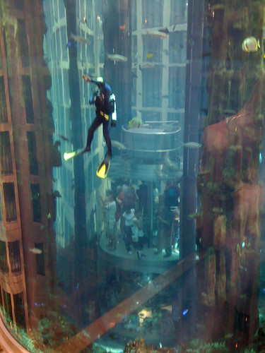
I'm back in Berlin at the Radisson Blu hotel in the Mitte district. It's not every day you get to look through your hotel room window and see 900,000 litres of sea water and around 2600 fish swimming around, 6 floors up, without a care in the world.

Window Cleaning. The Hard Way

The Berlin Aquadom even has its own team of cleaners, who clean the tank the hard way, from the inside, whilst wearing a wetsuit and SCUBA gear.

Normal geo related bloggage will return in the next post.

Crowd Sourcing The London Underground Tube Strike

From as early as 9.00 PM tonight, the London Underground network will be hit by a strike called by the RMT and TSSA unions. Again.

For Londoners this will probably come as no surprise, but this time around, the BBC are crowd-sourcing a map of station closures, services affected and the knock on impact to other forms of London public transport, using publicly submitted reports and media in addition to reporters on the street. It seems natural enough that this will be visualised on a map and in tonight's BBC London News, it was plainly evident that the BBC are using OpenStreetMap as the underlying map tiles for the visualisation.

You can see a snapshot of how the map looks, taken a few minutes ago; head over to the London Tube Strike Map for more updates as the strike starts to affect London.

“Tweet Responsibly”

For almost as long as there's been conferences there's been conference back-channels. The precise medium which forms the back-channel has morphed over time, from quickly scrawled notes passed amongst delegates, to SMS messages, to IRC (Internet Relay Chat for those of you old enough to remember what this is). With IRC, the back-channel became a conversation, recognisable amongst conference goers. Witty, informative, scathing, irreverent, the back-channel provides near real time information on how the conference is going and on how the current speaker's presentation is being received.

Twitter Shirt

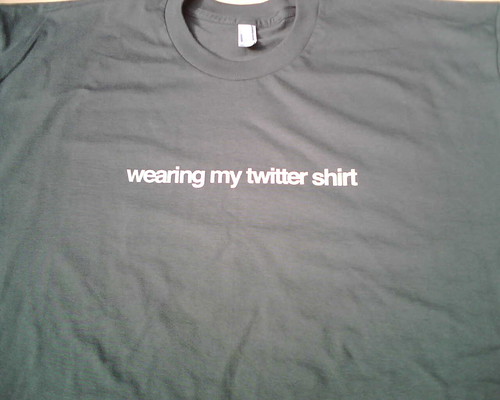
Which brings me to Twitter. These days Twitter has all but supplanted almost every other form of back-channel communication. Not every conference venue and conference organiser likes this. I was recently at a conference which provided no network connectivity in the conference hall at all. When questioned, the excuse was that "using laptops distract from what the speaker is saying". Ignoring the fact that 3G data dongles and smart phones are pretty much ubiquitous these days, it does make live demos and live blogging just a tad challenging. At the opposite end of the spectrum, some conferences actively encourage the Twitter back-channel, going so far as to publicise the official hashtag to be used and providing large screens running Twitterfall to provide immediate feedback to speaker and audience alike.

W3G – A Chair’s Eye View

Last year GeoCommunity, the annual conference of Britain's Association for Geographic Information, took the brave (and in my view totally necessary) step of branching out from their traditional GIS heartland audience (sometimes referred to somewhat disparagingly as paleotards) to take on board the views of the neo-geographers, Web 2.0 and LBMS community (sometimes equally disparagingly called neotards). Mud-slinging labels aside, both geographic communities benefitted from the Geo-Web Track as it was called. I was lucky enough to be asked to participate and the Geo-Web Track was a resounding success, for both the paleo-geography and neo-geography camps.

This year, attempting to build on the success of the Geo-Web Track, I was asked by the AGI to chair a one day conference to run on the day before GeoCommunity 2009. Originally pitched as a true unconference I went for an (un)conference, half way between the joyous informality of an unconference and the formality of an invited speaker conference. So we had both, unconference sessions (all of which were filled with ease) and a set of invited guest speakers and keynotes. Trying to think of a name, I came up with W3G ... the 3 W's of Geo, which had cropped up in a blog post in April of this year. Any resemblance in name between W3G and the W3C is, of course, purely intentional.
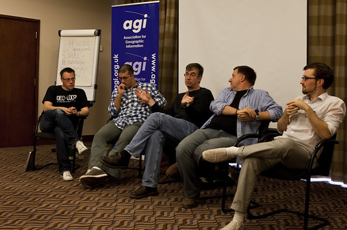
W3G Closing Panel

Attending any sort of conference is a tiring affair; chairing and organising one is truly exhausting. While most of the thanks on the day and afterwards were directed at me, the real thanks needs to go to my fellow organiser, Rollo Home, with the support of Chris Holcroft and Claire Huppertz, all of whom had their hands more than full with GeoCommunity starting the very next day after W3G.

As chair, I gave the opening introduction, to set the theme and tone of the day and to introduce the unconference element to those unfamiliar with the concept.

So should W3G have existed at all? The GeoWeb Track at GeoCommunity 2009 certainly showed that there was an appetite for the neo-geographic side of the Location Industry, so why not integrate W3G or the GeoWeb Track into the main GeoCommunity again? That's a difficult decision to come to ... whilst there was probably around 30% of the audience of W3G attending GeoCommunity, that still leaves 70% of the audience who were totally new to the AGI. Would they have paid the asking price of a GeoCommunity ticket? Probably not. The neo-geography side of things does tend to thrive on free or low cost events (with the notable exception of O'Reilly's Where 2.0 in Silicon Valley, which is both excellent and eye-wateringly expensive). So for this year at least, W3G served a valuable dual purpose, bringing the AGI to the attention of a community which probably didn't know it even existed and allowing a whole load of latent geographers to meet, talk, learn and network ... as well as consuming vast amounts of coffee, beer and curry. In that order.

We're already talking about repeating the success of W3G next year in some shape or form; something I definitely want to be involved in. But I would like to see the gap between the GIS heartland and the neo-geographers, which still seem to be a long way apart at times, narrowed or even closed. The AGI is eminently poised to help bring these two parts of the community together and GeoCommunity 2011 would be the ideal event to do this, making it a Geo Community in the truest sense of the word. In 2009 I questioned whether GeoCommunity would unite the two polarised worlds of geo ... the answer in 2010 is that we've take a few steps in the right direction, but we're still not there yet. Photo Credits: Paul Clarkel on Flickr.