29 Ancient Maps That Show How Our Ancestors Saw The World
Today's maps found on the interwebs.  le looked out around them, they couldn’t imagine how far the scope of the world extended beyond what stretched out before their own eyes. Their world was the land that surrounded and fed them, and as far as they knew, it extended no further.
Found at https://ift.tt/2q6MahO
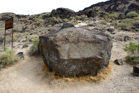 was carved by ancient peoples to map the area of the upper Snake River, possibly as long as 12,000 years ago. The map is believed to have been carved by the Shoshone-Bannock natives long before European contact.
  ty run-of-the-mill job these days—Google alone has scanned over 25 million titles. But some books need special treatment to make it into the digital world, and the Klencke Atlas held at the British Library took a lot of extra effort, Allison Meier at Hyperallergic reports.
