Posts tagged as "geotagged"

Mental Note to Self

I'd been told that the lesser spotted flight upgrade does happen. But despite travelling the Heathrow to San Francisco route on British Airways roughly once every three months for the best part of four years, despite knowing at least three members of the BA cabin crew who put me down on the upgrade list (but no promises, it's at the discretion of the Captain you know) and despite frequently travelling with a colleague whose best friend is not only a pilot but a BA pilot, the elusive upgrade had never happened. Until today.

The Trinity of Geo (Both Redux and Somewhat Late)

In October of 2009 I wrote that the trinity of geo was going to hit New York City. Translated, this meant that myself, Tom Coates (the man behind the creation of Fire Eagle and now roving Yahoo! Product Manager for User Location) and Aaron Cope (then chief geo wrangler and trouble maker at Flickr and now trouble maker at Stamen Design) were going to be descending on New York City for the Yahoo! Open Hack developer's conference. I also speculated that is was going to be geotastic. It was.

Ready for #openhacknyc

Now some 5 months later, the video footage that was shot in the Millennium Broadway Hotel, just off of Times Square has finally emerged blinking into the light of day so now would be a suitable time to revisit my talk, Place not Space; There's More to Geo than just Maps.

It would also be a suitable time to pair the slide deck with added video footage featuring genuine fatigue and jetlag.

Geo on the Horizon at Horizon Geo

Last Friday I ventured north to Nottingham, along with Ed Parsons, Steven Feldman and Muki Haklay to attend the one day Supporting the Contextual Footprint event run by the Horizon Digital Economy Research institute at the University of Nottingham. Along the way I discovered a manner of tracking my journey that I'd hadn't previously considered, but that's covered in a previous blog post.

The focus of the Horizon event was to discuss the infrastructure needed to support location in its role as a key context and to identify any research theme that came out of the discussions; a classic case of the ill defined and fuzzy interface between the commercial world and that of academia.

Deliberately (and Unexpectedly) Tracking My Journey

I've been tracking my journey and in doing so inadvertently uncovered a sea change in the way in which we view the whole thorny issue of location tracking.

Yesterday, Ed Parsons and I drove from London to Nottingham and back to attend the one day Supporting the Contextual Footprint event run by the Horizon Digital Economy Research institute at the University of Nottingham and I had Google Latitude running on my BlackBerry, with location history enabled, as I usually do.

Unofficial Google Latitude T-Shirt

Using the pre smartphone, pre GPS, pre Latitude method of writing it down, the journey went something like this:

Mistaking the Context for the End Game

This is a post about location (for a change); but it doesn't have to be about location as it's all about mistaking a vital element for the end game itself. I should explain.

I recently got contacted by a gentleman in the US who was looking to register a lot of domain names, in a manner which recalled the rush to buy domain names in order to make a profit as the dot com boom rushed headlong to become the dot bomb bust and which resulted in the unlovely pass-time of domain squatting.

After seeing a lot of mention of location, location based services and location based mobile services in the media, the position of location based services on Gartner's most recent hype curve and seeing a lot of acquisition activity in the location space, he was looking to register domain names with LBS in them.

Phi, Lambda and (Slightly Embarassing) Temporality

Longitude and latitude have been formally used as a geographic coordinate system offset from the Greenwich Meridian since the International Meridian Conference of 1884 in Washington D.C.

As a spatial coordinate system, longitude (abbreviated as φ, or phi) and latitude ( λ, or lambda) work very well in defining a point on the surface of the Earth. But to gain further meaning from a long/lat pair you either need some clever algorithmics or you need to plot the long/lat point on a map which even then will yield information only as good as that which is rendered on the map itself.

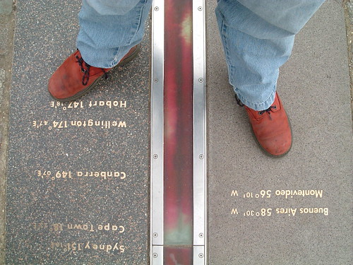
Astride The World

Which is why I think identifier systems, such as Yahoo's WOEID, add so much value. A WOEID adds a linked web of rich metadata, describing not only a point with a long/lat centroid, but also reinforces the concept of a place, with neighbouring and hierarchical relationships.

Coordinates describe the where of a place, identifiers such as WOEIDs describe the how of a place but both conveniently (in a slight embarrassed, foot shuffling short of way) overlook the when of a place.

Creative Commons in Action

I take a lot of photos, most of which end up on my Flickr photo stream. While some of them are taken with a proper camera  (though some would say that my Lumix FX12 isn't a proper camera), most of them are taken with my iPhone, which doesn't take great pictures but takes pictures which are good enough and with the added bonus that I have it on me almost all of the time.

My photos all used to be publicly accessible and with an all rights reserved copyright on them but then I lost my Flickr innocence, which was a bad thing at the time and switched all of my photos to friends and family visibility. About a week later, when I'd calmed down a bit, I went through all of my photo sets; photos of my family and of home stayed out of the public eye and stayed all rights reserved. But everything else, I opened up and changed the license to some rights reserved using the Creative Commons Attribution Share-Alike license.

WhereCamp EU - The Geo Unconference Experience for 180 People

51° 31' 36.8364" N, 0° 7' 44.0466" W

Entering the longitude and latitude above into one of the many online mapping sites on the web will  show you the St. Pancras branch of wallacespace, close to London's Euston and Kings Cross St. Pancras rail termini and seems a fitting and apt way to write a blog post about WhereCamp EU, the first geo unconference to be held in the United Kingdom and in Europe.

Deep In The Twitter (Developers) Nest

The last week has been crammed with planning for and finally realising the first WhereCamp unconference to be held in Europe. More of that later but before WhereCamp EU, there was the London Twitter Developer’s DevNest.

Angus Fox, one of the organisers of the DevNest, had first got in touch with me last year after the launch of the Yahoo! Placemaker web platform that allows recognition of place references in unstructured text. Placemaker plus Twitter status feeds seemed an ideal candidate for a mashup and Angus was keen to get me to talk to his hard-core Twitter and social media literate developer audience.

Thinking of Linking

Hyperlinks in the form of web links are the lifeblood of today's internet and world wide web. Examination of your web server's log files, either directly via tools such as Webalizer or indirectly via analytics services such as Yahoo's or Google's can show you who's visiting your web site or blogs.

But who's visiting your site isn't the whole picture; following a hyperlink is an active process. To complete the picture you need to find out who's linking to your site, which is a passive process.

Hyperlink

If you're running a blog you may be able to use trackbacks or pingbacks to find out when a site links to you, but only if the linking site support the trackback or pingback protocol and then only if this is enabled on both sides of the ping relationship.

So what about those sites which don't support trackbacks or pingbacks or who don't want to be discovered that they're linking to you?