Posts tagged as "place"

The Internet Seems To Like The Combination Of Maps And Innuendo

Oh people of the interwebs; you are indeed a wondrous thing. If you build something and put it up on the internet, you've no expectation that anyone will see it, let alone look at it. But it appears that the combination of innuendo and some vaguely sounding rude place names (actually with some very rude place names) seems to be something that the citizens of the internet actually like.

The map hit the internet at maps.geotastic.org/rude/ around lunchtime on the 6th. of February; since then, several things have happened.

Firstly, Eric Rodenbeck, the CEO of Stamen Design, whose map tiles I used on the Rude Map, dropped me an email to say he liked it. I'm a massive fan of the cartography that Stamen produces and this would, alone, be enough to make the making of the map worthwhile.

But then, the URL of the site started proliferating over Twitter ... including Jonathan Crowe, author of the late and utterly lamented Map Room blog.
Ooh That Sounds Rude; Mapping British Innuendo

No-one can really define what being British is, though many have tried. One thing that lots of people do seem to agree on is that part of being British is a love for and an appreciation of the British sense of humour. This can be roughly and with a sweeping generalisation said to consist of equal parts of finding fun in everyday situations Peep Show), satire and parody (Have I Got News For You), social awkwardness (The Office), surrealism and nonsense (Monty Python) and innuendo (the Carry On films).

Focus on that trait of innuendo for a moment. Could you possibly combine the British fondness for innuendo with geography and put it on a map? It turns out you can. So I did. It may be vaguely NSFW but there's real geographical data behind this.

Work+ - A Fantastic Idea For A Location Based App; Shame About The Metadata Though

I once wrote two posts saying that people are mistaking the context (location) for the end game and that location is (also) a key context, but most people don't know this. Two years or so after I wrote those posts, the concept of location based mobile services and location based apps shows no sign of dying off. I see lots of new location based apps and whilst they're almost always nice and glossy, not that many of them really grab you as a neat and innovative idea. But every so often, one does come along which makes you slap your forehead, like the scientists in the 80's ads for Tefal, and mutter under your breath ... that's so obvious, why didn't I think of that?

Location vs. Place vs. POI

With Nokia, Google, Facebook and a whole host of other players recognising the inherent value in the concept of Places and Points Of Interest (POIs), it's good to see that the World Wide Web Consortium (W3C), the standards body of the Web, is getting involved. On the 30th. September 2010, the W3C Points Of Interest Working Group (POIWG) was launched with a "mission to develop technical specifications for representation of POI information on the Web". I should pause to make a brief disclaimer here; I'm sitting on the POIWG as part of my day job with Ovi Places at Nokia.

Of course, in order to develop those technical specifications, we need to define what a POI is in the first place. There's a lot of acronyms flying around (3 in the first paragraph of this post alone) and a lot of conflicting terminology further confusing the matter. Even the most cursory of glances through Web content on this topic shows the terms Place, Location and POI being used interchangably and so as part of the discussion I tried to codify the difference between, and most importantly the inter-relationships between, these three seemingly straightforward terms. The genesis for this post first appeared on the POIWG public mailing list last week (and W3C working groups conduct their business as much as possible in public) but I've fleshed it out in a bit more detail here.

Quantity Or Quality? The Problem Of Junk POIs

In my recent talk to the British Computer Society's Geospatial Specialist Group, I touched on the "race to own the Place Space". While the more traditional geographic data providers, such as Navteq and Tele Atlas are working away adding Points Of Interest to their data sets, it's the smaller, social location startups, that are getting the most attention and media coverage. With their apps running on smartphone hardware, Foursquare, Gowalla and Facebook Places, amongst others, are using crowd sourcing techniques to build a large data set of their own.

For them to do this, the barriers to entry have to be very low. Ask a user for too much information and you'll substantially reduce the number of Places that get created; and thereby hangs the biggest challenge for these data sets. Both the companies and their users want the Holy Grail of data, quantity and quality. But the lower the barriers to entry, the more quality suffers, unless there's a dedicated attempt to manage and clean up the resultant data set.

Grepping And Grokking The Etymology Of Grep

I've been thinking a lot about the etymology of place names recently. That's a slightly verbose way of saying that I've been thinking about the origin of place names and where they come from. Take London for example. That's pretty easy as most sources of information seem to agree that London derives from Londinium, the name of the Roman settlement from which the modern metropolis of London grew.

Then there's Teddington, the town on the River Thames at the upstream limit of the Tideway, where I currently live. Some people believe that the name derives from Tide's End Town; Rudyard Kipling was one of the people who subscribed to this version of the name's origin. Scholars though tend to believe that the town was named after a Saxon leader, called either Todyngton or Tutington, which morphed into the modern day name over the centuries.

Your Place Is Not My Place; The Perils of Disambiguation

We take the art of geographic lookup for granted these days; type a place name into a form on a web site or feed it into a web service API and hey presto! Most of the time you'll be told whether or not the place name is valid or not and, in case there's more than one place with the same name, either asked to choose which one you mean or be presented with the most likely place.

Most of the time ... but not all of the time.

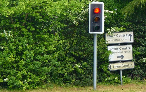
Which Way To The Town Centre?

The hey presto bit of the process seems at first glance to be relatively trivial but isn't. Just ask anyone who's had to implement a system that handles place names. Actually, the hey presto part is actually two discreet processes in their own right. First of all we need to identify a place, or whether indeed there's a place at all; this is usually called geoidentification.

Retiring The Theory of Stuff; But First, A Corollary

It's time to put the Theory of Stuff out to pasture. It's had a good life. It's appeared in 5 of my talk decks (or so Spotlight tells me), in 3 of my blog posts and continues to generate hits on my blog (or so my analytics tells me).

When I tell people I'm going to talk about my theory, a Mexican wave of shoulder slumping passes through the room, coupled with a prolonged sigh from an audience who've just resigned themselves to a slow painful death over the coming minutes. Luckily things perk up when my introductory slide of Anne Elk (Miss) and her Theory appears but even so, it's time to quit whilst you're ahead.

You may well ask, Chris, what *is* my theory?

But before I do ...

Phi, Lambda and (Slightly Embarassing) Temporality

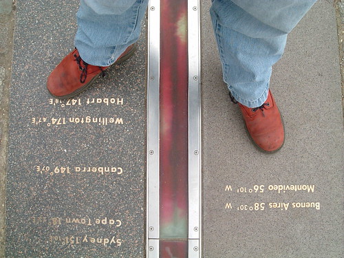
Longitude and latitude have been formally used as a geographic coordinate system offset from the Greenwich Meridian since the International Meridian Conference of 1884 in Washington D.C.

As a spatial coordinate system, longitude (abbreviated as φ, or phi) and latitude ( λ, or lambda) work very well in defining a point on the surface of the Earth. But to gain further meaning from a long/lat pair you either need some clever algorithmics or you need to plot the long/lat point on a map which even then will yield information only as good as that which is rendered on the map itself.

Astride The World

Which is why I think identifier systems, such as Yahoo's WOEID, add so much value. A WOEID adds a linked web of rich metadata, describing not only a point with a long/lat centroid, but also reinforces the concept of a place, with neighbouring and hierarchical relationships.

Coordinates describe the where of a place, identifiers such as WOEIDs describe the how of a place but both conveniently (in a slight embarrassed, foot shuffling short of way) overlook the when of a place.