Posts tagged as "speaking"

Risking Location Predictions at Mashup*'s Digital Trends 2011

Making predictions is not an easy thing. There are very few opportunities to get predictions right and a myriad of ways to get them wrong. At least if you make predictions in private then you're able to keep the horrible realisation of just how wrong you were to yourself. But making predictions in public just increases the scope for public humiliation.

Bearing this in mind, it was with a not insignificant amount of trepidation that I set out to predict some location trends for 2011. The mashup* team had asked me to talk and be part of a panel on Digital Trends and there was really no way I could extricate myself from some public location prognostications. So along with Dan Howe, Steve Kennedy, Laurence John, Andrew Gerrard and James Poulter I threw caution to the wind and came up with how I see location panning out over the forthcoming 12 months.

Society of Cartographers Redux

To be filed under the "slightly self promoting" department, earlier this year I was invited to speak at the Society of Cartographers Summer School in Manchester, UK. It's always great to be invited to speak at a conference but I was particularly excited by the SoC. The geo world I inhabit is one of data, APIs, platforms and data mining and aggregation techniques. Sometimes the map gets lost in all of this. So it was an honour to speak at an event where it was all about the map. The Summer School was written up in November's edition of the SoC Newsletter which is only available to society members, but with permission I've reproduced below the sections of the newsletter which cover my involvement.

Finding Inspiration And Teaching Myself Location History At The BCS Geospatial SG

With GeoBabel firmly put to rest, I was looking for inspiration when Andrew Larcombe asked me back to the British Computer Society's Geospatial Specialist Group to speak. After a week of drawing a blank, with Andrew sending gentle messages of encouragement via Twitter Direct Message (OI - GALE. TITLE. NOW!!) inspiration finally arrived from a variety of sources. Firstly there was Mashable's History of Location Technology infographic. Then there the brief history of location slides I'd used in a few of my previous talks. There was the rather fine 3D visualisation of geolocation history that Chris Osborne used at W3G and at GeoCom 2010. And then there were two questions that kept cropping up when speaking to people at conferences ... "this location stuff's only recent isn't it?" and "I can't keep up with this geo stuff, it's all moving too fast, where's it going?".

So I started to research this. I knew that location had a long history but I was taken aback to find out just how long that history was. I'd tended to think of the human race using longitude and latitude to work out their location sometime in the 1700's, about the same time as the race to make a working, reliable marine chronometer. It came as a bit of a shock to find out that longitude and latitude were first proposed in 300 BC and were first used to locate a position on the surface of the Earth in 200 BC. Focussing on use of location, on location sharing and on LBS/LBMS and putting GIS to one side I came up with A (Mostly) Complete & (Mostly) Accurate History Of Location (Abridged).

Talking GeoBabel In Three Cities (And Then Retiring It)

You're invited to speak at a conference. Great. The organisers want a talk title and abstract and they want it pretty much immediately. Not so great; mind goes blank; what shall I talk about; help! With this in mind, my first thought is normally "can I adapt, cannibalise or repurpose one of my other talks?". This sometimes works. If there's a theme which you haven't fully worked through it can serve you well.

But a conference audience is an odd beast; a percentage of which will be "the usual suspects". They've seen you talk before, maybe a few times. The usual suspects also tend to hang out on the conference Twitter back channel. Woe betide if you recycle a talk or even some slides too many times; comments such as "I'm sure I've seen that slide before" start to crop up. Far better to come up with new and fresh material each time.

W3G – A Chair’s Eye View

Last year GeoCommunity, the annual conference of Britain's Association for Geographic Information, took the brave (and in my view totally necessary) step of branching out from their traditional GIS heartland audience (sometimes referred to somewhat disparagingly as paleotards) to take on board the views of the neo-geographers, Web 2.0 and LBMS community (sometimes equally disparagingly called neotards). Mud-slinging labels aside, both geographic communities benefitted from the Geo-Web Track as it was called. I was lucky enough to be asked to participate and the Geo-Web Track was a resounding success, for both the paleo-geography and neo-geography camps.

This year, attempting to build on the success of the Geo-Web Track, I was asked by the AGI to chair a one day conference to run on the day before GeoCommunity 2009. Originally pitched as a true unconference I went for an (un)conference, half way between the joyous informality of an unconference and the formality of an invited speaker conference. So we had both, unconference sessions (all of which were filled with ease) and a set of invited guest speakers and keynotes. Trying to think of a name, I came up with W3G ... the 3 W's of Geo, which had cropped up in a blog post in April of this year. Any resemblance in name between W3G and the W3C is, of course, purely intentional.
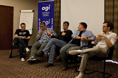
W3G Closing Panel

Attending any sort of conference is a tiring affair; chairing and organising one is truly exhausting. While most of the thanks on the day and afterwards were directed at me, the real thanks needs to go to my fellow organiser, Rollo Home, with the support of Chris Holcroft and Claire Huppertz, all of whom had their hands more than full with GeoCommunity starting the very next day after W3G.

As chair, I gave the opening introduction, to set the theme and tone of the day and to introduce the unconference element to those unfamiliar with the concept.

So should W3G have existed at all? The GeoWeb Track at GeoCommunity 2009 certainly showed that there was an appetite for the neo-geographic side of the Location Industry, so why not integrate W3G or the GeoWeb Track into the main GeoCommunity again? That's a difficult decision to come to ... whilst there was probably around 30% of the audience of W3G attending GeoCommunity, that still leaves 70% of the audience who were totally new to the AGI. Would they have paid the asking price of a GeoCommunity ticket? Probably not. The neo-geography side of things does tend to thrive on free or low cost events (with the notable exception of O'Reilly's Where 2.0 in Silicon Valley, which is both excellent and eye-wateringly expensive). So for this year at least, W3G served a valuable dual purpose, bringing the AGI to the attention of a community which probably didn't know it even existed and allowing a whole load of latent geographers to meet, talk, learn and network ... as well as consuming vast amounts of coffee, beer and curry. In that order.

We're already talking about repeating the success of W3G next year in some shape or form; something I definitely want to be involved in. But I would like to see the gap between the GIS heartland and the neo-geographers, which still seem to be a long way apart at times, narrowed or even closed. The AGI is eminently poised to help bring these two parts of the community together and GeoCommunity 2011 would be the ideal event to do this, making it a Geo Community in the truest sense of the word. In 2009 I questioned whether GeoCommunity would unite the two polarised worlds of geo ... the answer in 2010 is that we've take a few steps in the right direction, but we're still not there yet. Photo Credits: Paul Clarkel on Flickr.

Cartographically Speaking; Data (Lots), Maps (Not So Much), Problems (Many)

In September I'll be at the 46th. Annual Society of Cartographers Summer School at the University of Manchester where I'm lucky enough to have been asked to give a talk on geographic data. This topic should come as no surprise to anyone who's come across one of my blog posts.

I'll be talking about Welcome To The World Of The Geo Data Silo; Where Closed Data Is Open And Open Data Is Closed; the talk abstract is now up on the SoC web site and it's reproduced below.

Geo-Loco; Where The Geo-Wonks Meet The Geo-Clueless And All Points Inbetween

Last week I was in San Francisco, ostensibly to meet with fellow Nokians in Mountain View and Palo Alto, the homes of Google and Stanford University respectively. But I was also there to take part in a panel on the topic of "is geo loco a business or a feature?" at the Geo-Loco conference, chaired by geo-eminence grise Marc Prioleau.

With the explosion of interest in all things geo recently (and for once I think the hyperbole is justified) and thus a large amount of new conferences on the topic, I was somewhat skeptical of how Geo-Loco would pan out. But the presence of Marc Prioleau and other geo-rati such as LikeList's Tyler Bell, Urban Mapping's Ian White, Tom Coates, the man behind Yahoo's Fire Eagle and Waze's Di-Ann Eisnor, to name but a few, swayed me to participate.

I was interested to hear how Fred Wilson of Union Square Ventures would keynote but was sadly disappointed; it was a rambling and somewhat disjointed affair with little structure or insight; the sole exception of which was an interesting technique to quickly mashup your Foursquare check-ins on Google Maps. Thankfully Fred fared much better when interviewed one-on-one later in the day by John Batelle of Federated Media, which produced an engaging discussion on the state of the geo market; some of which I even agreed with.

Retiring The Theory of Stuff; But First, A Corollary

It's time to put the Theory of Stuff out to pasture. It's had a good life. It's appeared in 5 of my talk decks (or so Spotlight tells me), in 3 of my blog posts and continues to generate hits on my blog (or so my analytics tells me).

When I tell people I'm going to talk about my theory, a Mexican wave of shoulder slumping passes through the room, coupled with a prolonged sigh from an audience who've just resigned themselves to a slow painful death over the coming minutes. Luckily things perk up when my introductory slide of Anne Elk (Miss) and her Theory appears but even so, it's time to quit whilst you're ahead.

You may well ask, Chris, what *is* my theory?

But before I do ...

The Letter W and Hype (or Local) at the Location Business Summit

Each time I give my Hyperlocal or Hype (and Local) talk it morphs slightly and becomes more scathing of the term hyperlocal.

I started to write the talk for Where 2.0 in San Jose earlier this year and approached it from the point of a hopeful sceptic who was looking to be persueded that the long promised hyperlocal nirvana was either right here, right now or was at least looming hopefully on the horizon.

A month later and I had the pleasure of sharing the keynote slot with Professor Danny Dorling at the GIS Research UK conference at University College London and I revisited the theme. By this time any hope of hyperlocal nirvana had pretty much vanished.

Yesterday I took the talk out for the final time at the Location Business Summit in Amsterdam and the elephant in the room relating to hyperlocality had grown into a full blown herd of elephants.

The 3 W's of Geo (and hyperlocal deities and a pachyderm)

Earlier this week, Jeremy Morley from the Centre for Geospatial Research at the University of Nottingham and Muki Haklay at University College London got in touch with me. The GIS Research UK Conference was in full swing, and OpenStreetMap founder Steve Coast had had to drop out of the conference due to ill health; would I think about stepping in for the closing keynote of the conference?

Hedging my bets and guessing that few, if any, of the audience had been in San Jose at Where 2.0 a couple of weeks back, I gladly accepted and reshuffled, added to and polished my Where 2.0 deck to yield Hyperlocal Deities, Pachyderms, the Letter W, the Number 3 (and some Geo).