What's Wrong With OpenStreetMap? Have Your Say
At the end of this week, anyone with even a passing interest in OpenStreetMap will be descending on Girona to be at the annual mapfest that is the State Of The Map conference. Sadly I won't be there this year, as I mentioned in a post earlier this year. But Chris Osborne will and he's hosting a panel discussion under the intriguing title of What's Wrong With OpenStreetMap, with all the attendant controversy that such a title might engender. Yesterday, he asked for points around which to build the inevitable conversation that will ensure, so here's a list of points that I'd love to see debated.
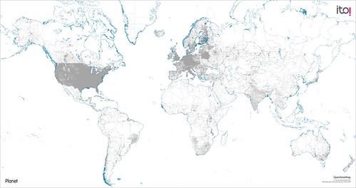 Is OSM Finished? The terms complete or finished mean different things to different people. OSM certainly has global coverage but at what point do you say that the project is complete and that it's refreshing and maintaining the data from this point on?
Is OSM Just About The Map? Building the OSM map has been an amazing achievement, but the current explosion of interest around location and geo has been as much about linking disparate geographical data sets as it has been about displaying a map. Should OSM look beyond just the map and become more about enhancing and expanding the reach and scope of the data?
To Fork Or Not To Fork? Healthy debate is an essential part of any collaborative process but from following some of the, err, heated discussions on the OSM mailing lists, healthy debate often descends into all out flame war, which doesn't solve anything and merely showcases a clash of mutually opposed viewpoints and personal agendas. Forking a project has given a fresh lease of life to many collaborative open source projects; is this the future for OSM?
The Unfortunate License Question? Crowdsourcing open geographic data certainly works. It's worked for OSM and even traditional map data vendors are seeing the benefit of this approach. But there is not and cannot be one single source of geographic truth; almost all successful uses of geographic data, both commercial and not for profit, aggregate data from a variety of sources to meet the particular needs of the project at hand. Yet despite a new OSM license, the terms and conditions are in some ways more restrictive than the traditional data vendor's licenses. The irony of which is that the license under which Britain's Ordnance Survey has released their open data allows aggregation and comingling far easier than that of OSM. Is the current OSM licence too restrictive to allow its use beyond the open source licensing community?
I look forward to seeing the Twitter steam and blog posts that come about after the panel has finished. Good luck Chris, hope you make it off of the stage in one piece!
Photo Credits: Peter Ito on Flickr.