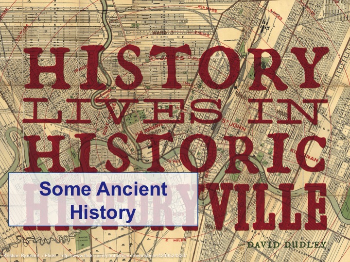
The Ubiquitous Digital Map (Abridged)
A lot of great conferences in the UK happen in London. But not all great conferences. For some, you have to travel a little further afield. Maybe to East Anglia. Or more specifically to Norwich, the county town of Norfolk. If you were in Norwich last week, you might have noticed that SyncConf was taking place and I'd been asked by ex-MultiMapper and co-founder of SyncConf, John Fagan to do a talk on something related to maps. How could I refuse?

SyncConf isn't a maps conference or a geo conference; it's a tech conference for the city's tech and startup community. So it seemed to make sense not to go full-on maps nerd for the conference audience but instead look at how we got to the current state of play where the digital map has become ubiquitous. It also allowed me to the opportunity to put a little bit of map porn into a slide deck.
This is how it turned out .. my slide deck and notes follow after the break.
Image Credits: Denise Bradley, Eastern Daily Press.


So, hello, I’m Gary and I'm from the internet. I’m a self-confessed map addict, a geo- technologist and a geographer. I’m Director of Global Community Programs for HERE, Nokia’s maps group. Prior to Nokia I led Yahoo’s Geotechnologies group in the United Kingdom. I’m a founder of the Location Forum, a co-founder of WhereCamp EU, I sit on the Council and Executive for the AGI, the UK’s Association for Geographic Information, I’m the chair of the W3G conference, a committer to the Mapstraction open source maps API and I’m also a Fellow of the Royal Geographical Society.

This is the abridged version of this talk; the original is a whole lot bigger but I’ve been warned that there’s a speed limit for slides in this county so I’ve had to pare the talk down and I’ll try hard not to exceed the slides-per-minute rate.

There are URLs in this talk but this is the only URL in the entirety of this talk you might want to take a note of. Although if you go there right now, it'll 404 on you, later today or tomorrow, this is where this slide deck, my notes and all the links you'll be seeing will appear on my blog. That’s an upper case “I” and an upper case “S” at the end of the URL by the way ...

Before I go any further I need to thank this man, Steven Feldman. There’s a lot of maps history in this talk and while it’s easy to get hold of snapshots of how the web looks right now, it’s less easy to get hold of snapshots about how the web used to look. So I’m thoroughly indebted to Steven for allowing me to rummage through his collection of digital maps history.

As the name of this talk probably suggests, there’s a lot of maps in the slide to come. Some people have called previous talks I’ve done map porn. This is true and I make no apology for it.
As the name of this talk probably suggests, there’s a lot of maps in the slide to come. Some people have called previous talks I’ve done map porn. This is true and I make no apology for it.

This isn’t the earliest map but it’s one of the earliest that’s recognisable as a map; it’s of the world as the Babylonians thought of it. Babylon is in the centre of the map and there's seven triangular islands, 3 of which are missing due to damage, in the "river of bitter water", or the sea. To me, the Babylon map is both art, hope and inspiration for the unmapped areas of their world and the best attempt of the age to be authoritative.

Fast forward several centuries to the "golden age of exploration" and while maps are more recognisably accurate, they're also art. But this art came at a price. You needed to be wealthy to commission such a map and such a map was often given as a notional gift to the rich and powerful to curry favour.

Furthermore maps were state secrets; sharing maps was sharing power and influence. The entrepreneurs of the time were the great navigators like Columbus and Magellan, their sponsors were kings and countries; their business plan were maps.

But maps don't just have to be geographically accurate. They can show data as well. This 1869 map by Charles Minard shows the losses suffered by Napoleon's army in his 1812 Russian campaign. Beginning at the Polish/Russian border on the led, the thick pinkish band shows the size of the army as they advanced towards Moscow. The thinner black band shows the ever decreasing size of the remains of the army as they retreated in the bitterly cold winter.

Another type of not necessarily geographically accurate map are the familiar mass transit and metro maps that you probably all recognise, all descended in some shape or form from Harry Beck's iconic map of London's Tube system.

So we have maps trying to tell the story of the world. Maps as art. Maps as power. Maps to get you around a city by train. But if you wanted to get around on foot or by car, up until just over 10 years ago, if you lived in a major metropolitan area you probably went around with a city street atlas, such as this one from London, with you.

I lugged one of these around for the best part of two decades, getting ever more battered and worn and filled with hand written navigation notes on how to get from A to B.

Then rather than carry around a local street atlas, people started instead to carry round a laser printed copy of the web map for where they wanted to go. Its this digital web map that I want to talk about
So fast forward to the early days of the internet, before the World Wide Web was formed, before people started to recognise URLs and web site addresses, before smartphones and tablets ...

Just like people questioned why you’d want to put a camera in a mobile phone, the early days of digital maps were met with incredulity by traditional map makers. Why on earth would you put a map onto a computer when you could carry a printed map out into the street with you. And while we take modern digital maps pretty much for granted, on our laptop and desktop, on our smartphone and on our tablets, they’ve actually been around a lot longer than most people realise ...

The story of the digital map starts over 30 years ago in the mid to late 1980’s. In 1984 a company called TeleAtlas formed in the Netherlands and the following year another company called Navtech formed in Silicon Valley. Both made rudimentary digital map data and TeleAtlas’s data would form part of ETAK, the first in-car navigation system.

In 1989 the rollout of the US controlled Global Positioning System starts. These days we know this as GPS.

Then, in 1991, at Cern in Switzerland a man called Tim Berners-Lee started to link a web of documents together and on this very NeXT cube (formed by Steve Jobs after he’d been ousted from Apple), the first webserver and web site was born and the World Wide Web officially started.

Mid 1993 and the final of the first set of GPS satellites were launched and the same month the first web server that served up maps went online; the Xerox PARC Map Viewer. These were static maps with none of the clicking, tapping, dragging, panning and zooming that we associate with online maps today.

In 1995, MultiMap launched. This is important. We tend to think of digital maps as being a purely Silicon Valley product thanks to Yahoo, Google and the like. But MultiMap was a pioneer and more importantly, it was a British pioneer.

MapBlast! was a web mapping service launched in the mid-1990s by Vicinity Corporation. It allowed website owners to incorporate maps in their own web pages, and was later syndicated across most major Web, wireless, handheld and interactive TV platforms including Yahoo!, Excite, Lycos, ATT Interactive and Palm, among others. By 2000, MapBlast was the #2 mapping site on the Web
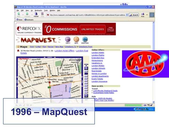
In 1996, MapQuest started; a subsidiary of R. O’Donelly that produced maps for the Blue Pages, the local information section at the front of US phone directories. MapQuest launched the first commercial web maps application. You could now put maps and other map related content on web sites. The maps came from Navteq and other sources, including MapQuest’s own. The Automobile Association of America were an early customer with a very primitive form of turn-by-turn navigation; you called the AAA, told them your route and they printed a map for your journey.

So we now have early digital maps. But they were small maps. Converting map vector data to raster images took time, the bigger the image the more time it took. Bandwidth over dial up modems also meant that putting a map in a browser was slow. So digital maps were small; they were quicker to produce and they downloaded quicker. They were also ugly maps; a stock cartography style and, in the UK, the dominance of OS map data didn’t make the maps appealing to the eye. Browsers were primitive compared with today and map functionality was very limited; no panning or zooming here. Even MultiMap used this way of producing digital maps though they did a much better job of it than most.

In 1997, MapXsite launched; the first dedicated web maps app for locating local stores and businesses, paving the way in the future for 100’s of Starbucks coffee store locator apps.

By February 1999, MapQuest had served up 76.2M maps and was the number 5 travel/tourism site on the web according to Media Metrix Inc. May 1999 and MapQuest goes public and raises $69M USD into the bargain. In July Microsoft sells its SideWalk property to TicketMaster and gets out of web mapping, starting the company’s on, off, on again affair with maps.

December 1999 and AOL buys MapQuest for $1.1Bn. That’s a £1,031M increase in less than 12 months. This is the start of the dot-com boom madness. Bear in mind that MapQuest were largely making money on B2B deals; their consumer web site was loosing money fast.

February 2000 and Vicinity goes public, raising $120M and peaking at a market cap of $2BN before dropping by 25%. Vicinity were trading as 160 times their revenue and losing over $1M a month at the time.

Up until 2000 there was two sorts of GPS signal – a degraded civilian one and and an accurate military one. This difference stopped in May 2000. As a result GPS starts to become widespread in civilian devices, leading to the explosion of personal satnav devices and the presence of GPS in our smartphones

This isn’t really web maps but it’s interesting as a taste of things to come. MultiMap launches a WAP service using TeleAtlas street level maps with travel directions, aerial imagery and London Underground maps. Suddenly everyone’s talking about mobile but due to a lack of mobile data bandwidth, a lack of applications and a lack of battery life, mobile won’t take off for another 7 or 8 years.

By March 2000, dot com madness is in full swing. The value of map data was completely distorted by the licensors; compare and contrast with the ridiculous prices paid for 3G licenses in the UK. Most of the original maps start-ups will go out of business as a result of the dot com boom turning into the dot bomb crash.

April 2002 and Microsoft is back in the mapping game with MapPoint.

October 2002 and Microsoft buys Vicinity, which already had $80M in the bank from its IPO for $96M. A great deal for Microsoft, or pouring money down the drain?

By 2003 MultiMap had served up over 1Bn maps!

Not many people realise that Yahoo were the first people to launch slippy maps, where you can click and drag to pan and zoom the map, and integration with search. One of the original engineers behind Vicinity jumped ship to help Yahoo! launch their maps; I worked with him whilst I was at Yahoo! and he’s still there.

By 2004 things are changing and starting to morph into what we now recognise as today’s web map landscape and players. Google launches Local, searching local business listings and displaying the results on a map. Sounds familiar? It’s worth noting that in 2003-2005 Google used MapQuest for their maps.

Towards the end of 2004 and maps are the most popular online activity according to the Pew Internet & American Life Project survey. Email and online chat was number 2.

The same month, a man called Steve Coast presented ideas for a publicly editable map of the world ... OpenStreetMap ... at EuroFOO after being inspired by the success of Wikipedia and a growing frustration with the license around proprietary data in general, but in the UK in particular.

October 2004. Google acquires Where 2 technologies, getting a tile server that was capable of serving up map tiles to a desktop client, with early use of AJAX. At the same time, the cost of data storage falls to < $0.50 a GB (today’s prices are closer to $0.07 a GB) ... suddenly storing all of that map data becomes cheaper and easier.

The same month, Google also acquires Keyhole and 9 months later Google Earth launches.

Despite being phenomenally popular, web maps were limited by complexity, cost and lack of interaction. Developing a web map app was complex, needing expensive maps and knowledge of how to manipulate geographic and spatial data sets. Surely there was an easier way to use maps on the web? Then, in 2005, there was.

February 2005 and Google Maps launches; apparently maps can be fun and useful. Firstly in the US, then in Japan, Canada and the UK.

2 months later and the first maps mashup emerges; a ride sharing app, built internally at Google using an undocumented API.

This undocumented API didn’t remain private for long and by June people were discovering it and producing their own mashups, such as Housing Maps and the Chicago Crime Map.

Google’s technology is being used in a way they didn’t foresee. Google are paying licensing fees for maps data and the unofficial mashups are getting this for free. What should Google do? Slam the door in the faces of this new and rapidly developing way of using maps?

Instead, John Hanke (ex of Keyhole) formally released the Google Maps API. It made sense. Google needed the internet to grow; more web content to index; more space to place ads on; more brand recognition. What would this free maps API do to the other businesses in this sector? I don’t think they took it too seriously ... at least to start with.

Google’s Maps API was followed in quick succession by similar offerings from Yahoo! and from Microsoft.

And as maps APIs explode across the web, the Open Source communities start to take notice too.
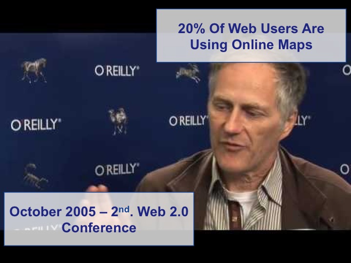
In 2005, O’Reilly publish Web Mapping Illustrated and the first Where 2.0 conference soon follows. 20% of web users are now using online maps.

In May 2006 a group of OSM mappers took a trip to the Isle of Wight. This is what the OSM map looked like when they arrived. And this is what it looked like 2 days later; completely mapped.

June 2006 and the Enterprise and Google start to court each other and 24% of web users worldwide are using web maps; that figure increases to 45% in the UK and 40% in the US

By 2006, web mapping and location technologies are starting to attract the media and with Where 2.0 and Web 2.0 in full swing, the GeoWeb emerges as a term.

In November the OS demos OpenSpace, even if it did take a year to release.

In December people start talking about Neogeography
a socially networked mapping platform which makes it easy to find, create, share, and publish maps and places Di-Ann Eisnor
Neogeography means new geography and consists of a set of techniques and tools that fall outside the realm of traditional GIS, Geographic Information Systems. Where historically a professional cartographer might use ArcGIS, talk of Mercator versus Mollweide projections, and resolve land area disputes, a neogeographer uses a mapping API like Google Maps, talks about GPX versus KML, and geotags his photos to make a map of his summer vacation. Essentially, Neogeography is about people using and creating their own maps, on their own terms and by combining elements of an existing toolset. Neogeography is about sharing location information with friends and visitors, helping shape context, and conveying understanding through knowledge of place. Lastly, Neogeography is fun Andrew Turner

At the start of 2007, Google launches StreetView to an at best indifferent public and at worst to cries of invasion of privacy. Initially using Immersive Media data, soon Google are driving the streets, but with cameras that aren’t only looking from side to side but also up and down.

The following month Google adds draggable routing to their maps. Originally using Telcontar but replaced with Google’s own technology a year later. As Google’s Ed Parsons notes “routing algorithms aren’t rocket science; by scaling them are”. Notice the continuing pattern here. Google buys technology and then builds on top of it. Other web maps vendors are left trailing by this move.

By July there’s sufficient OSM users to hold the first annual State Of The Map conference.

By 2007, there’s 50,000 Google Maps mashups. Google Maps has 71.5M users per month; Google Earth 22.7M users per month
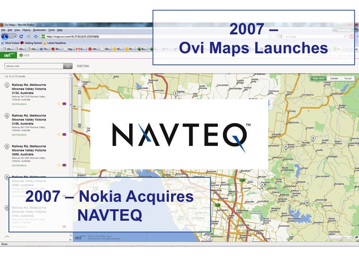
In 2007 Nokia acquires NAVTEQ and launches Ovi Maps

The same year, Microsoft is firmly back in the web maps game and acquires MultiMap.

In 2008 Google wants to save on the costs that its web mapping activities incur. The main cost saver is the licensing fees that Google pays TeleAtlas. Remember those StreetView cameras that were pointing up and down? Google is making their own map?

Just look at this for a year’s releases to Google Maps, difficult for the other players to keep up! 21 announcements in 1 year! 1. On January 22, 2008, Google expanded the Local Onebox from 3 business listings to 10 2. On February 20, 2008, Google Maps allowed searches to be refined by User Rating & neighbourhoods. 3. On March 18, 2008, Google allowed end users to edit business listings and add new places. 4. On March 19, 2008, Google added unlimited category options in the Local Business Center. 5. On April 2, 2008, Google added contour lines to the Terrain view. 6. In April 2008, a button to view recent Saved Locations was added to the right of the search field. 7. In May 2008, a "More" button was added alongside the "Map", "Satellite", and "Terrain" buttons, permitting access to geographically-related photos on Panoramio and articles on Wikipedia 8. On May 15, 2008, Google Maps was ported to Flash and ActionScript 3 as a foundation for richer internet applications. 9. On July 15, 2008, walking directions were added. 10. On August 4, 2008, Street View launched in Japan and Australia. 11. On August 15, 2008, the user interface was redesigned. 12. On August 29, 2008, Google signed a deal under which GeoEye would supply them with imagery from a satellite and introduced the Map Maker tool for creation of map data. 13. On September 9, 2008, a reverse business lookup feature was added. 14. On September 23, 2008, information for the New York City Metropolitan Transit Authority was added.

And finally in 2009 and in the US at least, Google ways goodbye to TeleAtlas.

Jul 2010 and MapQuest starts using open source and open data through OpenStreetMap. There’s several drivers here. One is cost. Another is a trial to see how good crowd sourced maps really are. Microsoft follows suite, announcing use of OSM data and OSM’s founder, Steve Coast, joins Microsoft.

By the end of 2010, 350,000 web sites are using Google’s Maps API
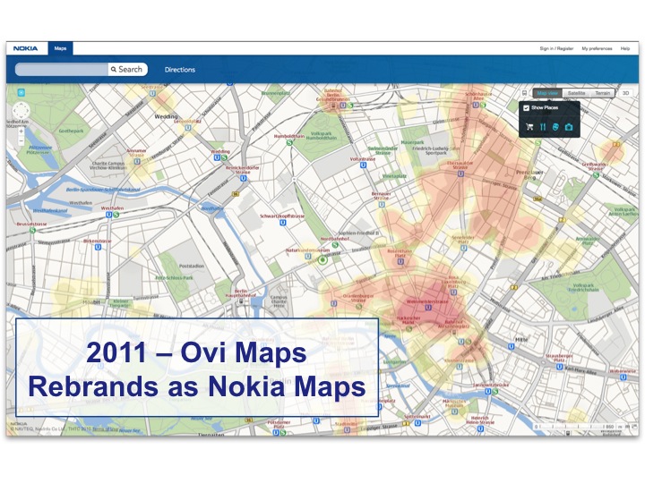
In 2011, Nokia’s Ovi maps rebrand to Nokia Maps
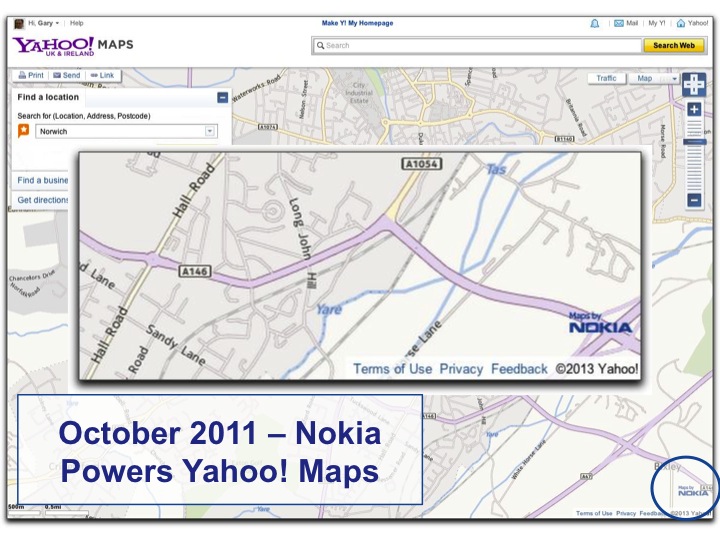
Nokia starts to build on the strength of the mapping services gained by acquiring NAVTEQ and partners with Yahoo!, replacing their native maps with Nokia’s own

And then something happened that really brought the ubiquity of digital maps, on your phone or tablet, to the mainstream media’s attention. All of a sudden tech industry commentators, who should really know better and who had been proclaiming that making maps wasn’t that hard, changed their tune and proclaimed that making usable digital maps was actually hard after all.

Up to and including version 5, Apple’s iOS had a maps app. It may have been called just “Maps” but it used Google’s mapping technologies on the back end. It was, and up to the end of version 5, remained one of the most popular and often used apps that came on a new iPhone or iPad. But in September 2012 when Apple released iOS 6, the maps app, still called “Maps” was replaced by the much heralded Apple native offering and millions of anguished iOS used cried out ...

... as they got directed onto the middle of an airport runway

... as bridges just vanished

... and as Las Vegas apparently melted under the heat of the midday Nevada sun
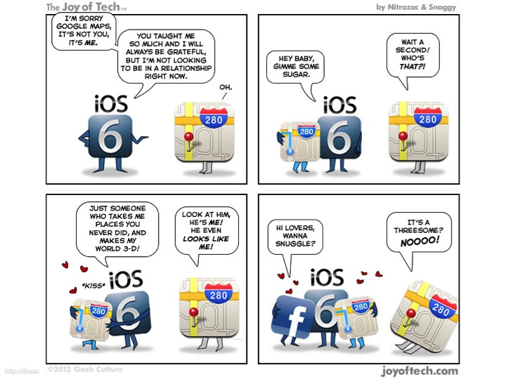
Originally Google was seen by Apple as a partner but for a variety of reasons, including the growth of Google’s Android phone OS, Apple decided to replace Google’s maps with their own. Apple makes an embarrassing public apology and recommends rival mapping platforms including those by Nokia, Microsoft and MapQuest as alternative while they make Apple Maps better.

In November 2012, Yahoo! finally shuts down their maps API, after partnering with Nokia and NAVTEQ to provide their mapping services. Despite being one of the digital maps pioneers, Yahoo! is out of the maps game.

Capitalising on the problems surrounding Apple’s maps, Google releases a native iOS app and quickly gains 10M downloads in 48 hours as iOS users sigh with relief.

Just as with Yahoo!, Microsoft and Bing pretty much exit the mapping game as Nokia takes over their mapping services

And Nokia maps rebrands as HERE maps in San Francisco

So that’s the story of the ubiquitous digital map up until the present day. I’ve missed out a lot of other significant developments and milestones in this story but this is the abridged version. But where does the digital map go from here?

The explosion of maps, location based services and digital cartography has been made possible by several factors ... the ever falling price of data storage. In 1980 a 26 MB disk drive cost $5,000, that’s $193,000 per GB. By 1990, the cost per GB had fallen to $9,000 per GB. In 2000 that cost was down to around $15 per GB and in 2009 a 1 TB drive cost just $75, working out at $0.07 per GB. Over the last 30 years, space per unit cost has doubled roughly every 14 months (increasing by an order of magnitude every 48 months).

At the same time, CPUs have got faster as Moore’s Law continues to be true and the number of transistors on an integrated circuit doubles roughly every two years. Digital maps take up a lot of data and a lot of computing power to render and this has got progressively easier with each passing year.

Of course, the best digital maps in the world are severely reduced in effectiveness if the only way people can access them is via a dial up modem, so hand in hand with cheap storage and faster processors, the availability of broadband internet connections and 3G and now 4G mobile data networks have allowed digital maps to become ever more widespread and easier and faster to access.

Although a lot of the original pioneers have led the playing field, either sinking as part of the dot bomb crash or outsourcing to other maps providers, such as Yahoo! and Microsoft have done

And although there’s been massive consolidation and concentration in the map market, with Nokia buying NAVTEQ, TomTom buying TeleAtlas, Google making their own maps and OSM generally disrupting everyone

There’s been an explosion of interest in digital maps and the way in which these maps are used over the last few years

And we’ve gained a whole new set of terms in the English language into the bargain.

It’s never been easier to put a map onto a mobile device or onto a web site and companies such as MapBox are capitalising on this by letting you not only make your own maps but also letting you create your own style of maps

I started this talk with the notion that early maps were art and I think we’ve come full circle, with companies like San Francisco’s Stamen producing maps that are not only effective but are also, to my mind at least visually gorgeous and qualify as art.

The growth, variety and use of the ubiquitous digital map shows no sign of stopping; I think the state of the map, to steal OpenStreetMap’s conference name, is one with a very bright future indeed.

Finally, here’s that short URL again ...

... and thanks for listening