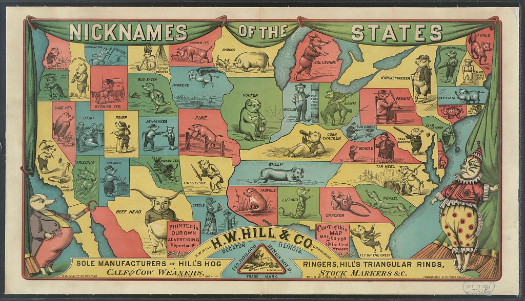
Pigs On A Map
Each time I find a new map I always end up learning something, sometimes directly from the map, sometimes from the content of what the map is trying to show. But I always end up learning something. In the case of this map, from H. W. Hill and Co from Decatur, Illinois circa 1884, I learnt that ...
- That you really can put pigs on a map.
- That in the 1880s each US state (apparently) had a nickname for a pig. Or is it that the States have nicknames that are best represented by pigs? Or maybe something else entirely.
- What a hog ringer is. Apparently it's a device for putting rings in the noses of pigs. Ouch.
How much use this information will be to me is yet to be decided, but every piece of information you learn might come in useful someday, even from this map.
Image Credits: US Library of Congress.