Posts tagged as "berlin"

Putting The Tube On The Grid; A Geeked Out Cartographical Recipe

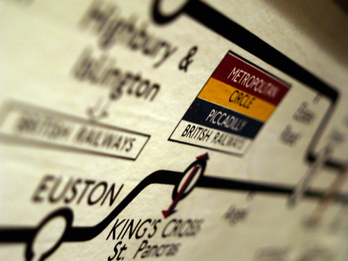
Here's a simple, cut-out-and-keep recipe for making a very geeked out update on a cartographical classic. First, take a classic and iconic map which appeals to both the map geek in you as well as the Tube geek in you. Harry Beck's 1931 reworking of the map of the London Underground system will do nicely.

Old School Tube

Next, take a classic, 1980's movie which appeals to both the scifi fan and the computer nerd in you and classifies as a guilty pleasure as an added bonus. Disney's 1981 Tron fits the bill here.

Tron Poster

Add the ingredients, mix well and serve. The end results might just look like Kevin Flynn's version of the London Underground network on The Grid.

Tron - Tube Map

To paraphrase Kevin Flynn (the Tron character not the artist) ... "Who's that guy?", "That's Tron. He fights for the Tube Users".

Photo Credits: thehutch on Flickr and Kevin Flynn on Deviant Art.

"Ich Bin Geograph" - WhereCamp EU Is Coming To Berlin

In March 2010, Chris Osborne and myself transplanted the post-Where 2.0 WhereCamp from Silicon Valley and brought it to London. Judging by the feedback and comments we got during and after the event, it was a geotastic success and showed that Europe had an appetite for a 2 day, free, unconference on all matters geo. After a brief northbound sojourn as WhereCamp UK in November 2010, we're happy to announce that WhereCamp EU is back for 2011 and with a distinctly European flavour.

Ovi Maps. Made here. In Berlin

Whilst the venue is yet to be confirmed, WhereCamp EU will be taking place on the 27th and 28th of May in Berlin.

We'll keep you posted with more details on the WhereCamp EU blog , on Lanyrd and on our Twitter feed.

"Ich Bin Geograph" (as Google translate tells me).

Airport Security X-Ray Oddness

Since I started my role at Nokia in Berlin in May of last year I've swapped the daily commute from home to work by train to a weekly commute by plane. This means I have to pass through airport security at London's Heathrow and Berlin's Tegel airports around twice a week. I tend to travel as light as I can, with a hand baggage sized suitcase so I can get off the plane and out of the airport as quickly as I possibly can, something Tegel airport excels at.

Taking the law of averages into account, I should be subject to random additional security searches and although the law of averages is generally considered a fallacy, about once a month my hand baggage gets that extra special level of attention. But it always seems to be for the same thing.

Lachrymose Cartography

After yesterday's admittedly bleak look at how not to use a map, I thought it worthwhile to look at a far more upbeat use of a map. This particular gem has been doing the rounds for a long long time, but I've no idea where it originated from (if you know, then please let me know in the comments).

As a map it's a fairly simple affair, inspired by Andrew Lloyd Webber's and Tim Rice's 1978 musical Evita, showing which countries should and which countries shouldn't cry for you.

So now you know.

Just Because You Can Put Something On A Map ...

A quick review through last year's posts shows a fairly consistent theme of mine; that despite the absence of the map in many of today's location services sometimes the map is the best way of simply presenting information in a readily accessible and understandable form.

But a map is much more than just a visualisation for overlaying data upon, a map says as much about the fears, hopes, dreams and prejudices of its target audience as it does about the relationship of places on the surface of the Earth.

Remapping The World By Population Size

From the department of cartographical curiosities comes this wonder; a map of the world but with the countries changed so that their population size corresponds to the size of each country. It's a map of the world; but not as we know it and has cropped up in several places online, including Frank Jacob's excellent Strange Maps blog.

World Map By Population Size

In this new world order, the United Kingdom now sits, landlocked, in the middle of Africa, where the Republic of Niger is usually found and Germany has migrated in a South Easterly direction and now sits where you'd expect to find Saudi Arabia. The map also notes the interesting coincidences that the United States, Yemen, Brazil and Ireland don't actually move and correspond precisely to their place in the population ranking.

Photo Credits: JPALMZ (original source unknown).

Another Category Of Place You Really Don't Want To Check In To

There are some places you really don't want to check into using one of the many location based social networks. There's a variety of suggestions of this nature on the web including funeral homes, an ex-partner's house, jail or the same bar (every night). It now seems you can add military bases (when you're in a war zone) to the list.

Camp Phoenix

A recent report highlighted concerns that the US Air Force has over troops using location based apps, with the Air Force posting a warning on an internal web site on the matter.

"All Airmen must understand the implications of using location-based services," said a message on the internal Air Force network. The features, such as Facebook's 'Check-in,' Foursquare, Gowalla, and Loopt "allow individuals with a smartphone to easily tell their friends their location," it said. "Careless use of these services by Airmen can have devastating operations security and privacy implications," said the message, which was posted on November 5, according to spokesman Major Chad Steffey.

The age old adage about Military Intelligence being an oxymoron springs to mind.

A First Step Towards Indoor Navigation. Literally

The problems started the moment GPS became a commodity and made the transition from the car to the mobile device. Nowadays, GPS can be found in a vast range of smartphones and navigation is possible without being confined to your car. Of course, it's not always a great experience. GPS works best when there's a direct line of sight to the satellites whizzing around over your head and there are times when you just can't get a GPS lock. A-GPS was devised to help with such situations, allowing your location enabled to device to take advantage of a variety of other sensors, such as cell tower and wifi triangulation technologies.

But even then, GPS just doesn't work indoors most of the time and indoor location and routing has become something of the Holy Grail for navigation technology vendors. Granted there have been lots of technologies developed which use non A-GPS technologies such as RFID and other near field sensors. But so far these all require a not insignificant investment to install and require specialist devices to take advantage of; none of which are as ubiquitous as the combination of smart phone and GPS.

Maybe we're looking too deeply at this challenge. Take a category of location that lots of people go to, such as shopping malls, where GPS usually isn't available, and map each mall to a high degree of accuracy, both in terms of the layout of the mall and in terms of the stores and concessions in that mall. Add in key features, such as multiple levels, staircases, escalators and lifts and you can build a spatial map of the mall which doesn't need sensors. Simply tell your phone where you are and where you want to go and you can provide simplistic directions, without the need for GPS.

Through The (New Office) Window

At the weekend myself and the rest of the Ovi Places team found ourselves re-geolocated from the Nokia office in Invalidenstraße in the Mitte district of Berlin to a new office in Schönhauser Allee in the Prenzlauer Berg district. While the office coffee hasn't improved, the view from my desk certainly has.

Through The (New Office) Window

From left to right the view takes in the Fernsehturm, (East) Berlin's TV tower, Schönhauser Allee, looking towards Rosa-Luxemburg-Platz U-Bahn station on the U2 line and the dome of the Berlin Cathedral, better known as the Berliner Dom. I could get used to this view.