Posts tagged as "geotagged"

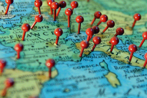
Does Location Need Some PR Love?

In an interview with GoMo News earlier this year, I talked about "the Bay Area bubble", this is the mind-set found in Silicon Valley "where a lot of the products and services coming out seem to think your user will always have a smartphone, and will always have a GPS lock with an excellent data connection". But does the so called location industry live in its own version of the Bay Area Bubble? Let's call it the "location privacy bubble" for the sake of convenience.

Last week an article entitled "Can you digital photos reveal where you live?" was posted on the Big Brother Watch blog; pop over there and read it for a moment, it's only three paragraphs long ...

Creative Use Of Robots

I'm not talking about vaguely human looking machines here, the sort that crop up in Forbidden Planet and Lost In Space, waving their metal arms and saying things like "Danger Will Robinson". What I'm talking about is a small file called robots.txt.

T is for Tofu Robot

If you run your own web server you probably have one of these. It tells the web robots sent out by the search engines, such as Google, Yahoo! and Bing, what pages on your web site should and shouldn't be indexed and searchable. This doesn't mean that those pages can't be viewed, just that they shouldn't be able to be searched for.

Most of the time, a web site's robots.txt file contains stuff that is only of interest to the owner of the site and to people who specialise in getting the content of your web site to figure prominently in search engines. But sometimes, if you're willing to poke around a bit, they contain hidden gems, like a job advert for one of those aforementioned web search specialists, hidden in the UK Daily Mail's robots.txt file.

Geolocating Yourself? In Europe, You're Not Alone

Exposure 2010, the recent study by Orange and TNS, makes for some interesting reading for the location industry. Although it should be taken with a large pinch of salt from the pot labelled lies, damned lies and statistics, the study's report shows the significant increase in use of geolocation services within the mobile space.

Pushpins in a map over France and Italy

In the UK, France, Spain and Poland, geolocation services occupy the 3rd, 2nd, 1st and 2nd slots respectively for most used mobile services. While the report only breaks geolocation down into two categories, streetmap/GPS and social networks, it's not difficult to see how the perception that location is finally going mainstream is worth some merit.

Quantity Or Quality? The Problem Of Junk POIs

In my recent talk to the British Computer Society's Geospatial Specialist Group, I touched on the "race to own the Place Space". While the more traditional geographic data providers, such as Navteq and Tele Atlas are working away adding Points Of Interest to their data sets, it's the smaller, social location startups, that are getting the most attention and media coverage. With their apps running on smartphone hardware, Foursquare, Gowalla and Facebook Places, amongst others, are using crowd sourcing techniques to build a large data set of their own.

For them to do this, the barriers to entry have to be very low. Ask a user for too much information and you'll substantially reduce the number of Places that get created; and thereby hangs the biggest challenge for these data sets. Both the companies and their users want the Holy Grail of data, quantity and quality. But the lower the barriers to entry, the more quality suffers, unless there's a dedicated attempt to manage and clean up the resultant data set.

As Location Goes Mainstream, So Does The Potential For Abuse

Geolocation isn't really anything new. In a lot of cases we've come to expect it. Most smartphones sold today have an on-board GPS receiver and it's considered a selling point for a handset to have one. Today's mobile mapping applications and Location Based Mobile Services make use of the location fix that GPS provides. We're used to our technology saying "you are here". Without this there'd be no Ovi Maps, no Google Maps, no Foursquare and no Facebook Places.

Long before we put up a network of over 20 satellites a less accurate version of geolocation was available. Pretty much anything that puts out a signal in the radio spectrum can be used to triangulate your position, if there's enough radio sources spead out over a wide area and if someone's done the leg work needed to geolocate you based on the position and strength of those radio sources. This can be done with mobile cell towers, with radio masts and more recently with the proliferation of wifi enabled access points, both in people's homes, in offices and in public areas.

Finding Inspiration And Teaching Myself Location History At The BCS Geospatial SG

With GeoBabel firmly put to rest, I was looking for inspiration when Andrew Larcombe asked me back to the British Computer Society's Geospatial Specialist Group to speak. After a week of drawing a blank, with Andrew sending gentle messages of encouragement via Twitter Direct Message (OI - GALE. TITLE. NOW!!) inspiration finally arrived from a variety of sources. Firstly there was Mashable's History of Location Technology infographic. Then there the brief history of location slides I'd used in a few of my previous talks. There was the rather fine 3D visualisation of geolocation history that Chris Osborne used at W3G and at GeoCom 2010. And then there were two questions that kept cropping up when speaking to people at conferences ... "this location stuff's only recent isn't it?" and "I can't keep up with this geo stuff, it's all moving too fast, where's it going?".

So I started to research this. I knew that location had a long history but I was taken aback to find out just how long that history was. I'd tended to think of the human race using longitude and latitude to work out their location sometime in the 1700's, about the same time as the race to make a working, reliable marine chronometer. It came as a bit of a shock to find out that longitude and latitude were first proposed in 300 BC and were first used to locate a position on the surface of the Earth in 200 BC. Focussing on use of location, on location sharing and on LBS/LBMS and putting GIS to one side I came up with A (Mostly) Complete & (Mostly) Accurate History Of Location (Abridged).

Talking GeoBabel In Three Cities (And Then Retiring It)

You're invited to speak at a conference. Great. The organisers want a talk title and abstract and they want it pretty much immediately. Not so great; mind goes blank; what shall I talk about; help! With this in mind, my first thought is normally "can I adapt, cannibalise or repurpose one of my other talks?". This sometimes works. If there's a theme which you haven't fully worked through it can serve you well.

But a conference audience is an odd beast; a percentage of which will be "the usual suspects". They've seen you talk before, maybe a few times. The usual suspects also tend to hang out on the conference Twitter back channel. Woe betide if you recycle a talk or even some slides too many times; comments such as "I'm sure I've seen that slide before" start to crop up. Far better to come up with new and fresh material each time.

The Plains Of Awkward Public Family Interactions And The Bay Of Flames

Not content with pointing out the fun you can have with tracking your location, xkcd, the webcomic of romance, sarcasm, math and language has branched out into making maps. The updated map of online communities shows the volume of daily social activity across all of the online world, and not just the high profile ones that get the press coverage.

Click through for the full size versions and loose yourself in the plains of awkward public family interactions, the Bay Of Flames and other geographical wonders.

Through The (Fish Tank) Window

And in a change from my normal bloggage, I'm forsaking the usual posts about matters geo, location and maps and briefly returning to my occasional "through the window" series of posts.

I'm back in Berlin at the Radisson Blu hotel in the Mitte district. It's not every day you get to look through your hotel room window and see 900,000 litres of sea water and around 2600 fish swimming around, 6 floors up, without a care in the world.

Window Cleaning. The Hard Way

The Berlin Aquadom even has its own team of cleaners, who clean the tank the hard way, from the inside, whilst wearing a wetsuit and SCUBA gear.

Normal geo related bloggage will return in the next post.

Crowd Sourcing The London Underground Tube Strike

From as early as 9.00 PM tonight, the London Underground network will be hit by a strike called by the RMT and TSSA unions. Again.

For Londoners this will probably come as no surprise, but this time around, the BBC are crowd-sourcing a map of station closures, services affected and the knock on impact to other forms of London public transport, using publicly submitted reports and media in addition to reporters on the street. It seems natural enough that this will be visualised on a map and in tonight's BBC London News, it was plainly evident that the BBC are using OpenStreetMap as the underlying map tiles for the visualisation.

You can see a snapshot of how the map looks, taken a few minutes ago; head over to the London Tube Strike Map for more updates as the strike starts to affect London.