Posts tagged as "geotagged"

“Tweet Responsibly”

For almost as long as there's been conferences there's been conference back-channels. The precise medium which forms the back-channel has morphed over time, from quickly scrawled notes passed amongst delegates, to SMS messages, to IRC (Internet Relay Chat for those of you old enough to remember what this is). With IRC, the back-channel became a conversation, recognisable amongst conference goers. Witty, informative, scathing, irreverent, the back-channel provides near real time information on how the conference is going and on how the current speaker's presentation is being received.

Twitter Shirt

Which brings me to Twitter. These days Twitter has all but supplanted almost every other form of back-channel communication. Not every conference venue and conference organiser likes this. I was recently at a conference which provided no network connectivity in the conference hall at all. When questioned, the excuse was that "using laptops distract from what the speaker is saying". Ignoring the fact that 3G data dongles and smart phones are pretty much ubiquitous these days, it does make live demos and live blogging just a tad challenging. At the opposite end of the spectrum, some conferences actively encourage the Twitter back-channel, going so far as to publicise the official hashtag to be used and providing large screens running Twitterfall to provide immediate feedback to speaker and audience alike.

W3G – A Chair’s Eye View

Last year GeoCommunity, the annual conference of Britain's Association for Geographic Information, took the brave (and in my view totally necessary) step of branching out from their traditional GIS heartland audience (sometimes referred to somewhat disparagingly as paleotards) to take on board the views of the neo-geographers, Web 2.0 and LBMS community (sometimes equally disparagingly called neotards). Mud-slinging labels aside, both geographic communities benefitted from the Geo-Web Track as it was called. I was lucky enough to be asked to participate and the Geo-Web Track was a resounding success, for both the paleo-geography and neo-geography camps.

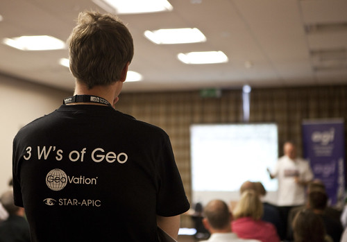
This year, attempting to build on the success of the Geo-Web Track, I was asked by the AGI to chair a one day conference to run on the day before GeoCommunity 2009. Originally pitched as a true unconference I went for an (un)conference, half way between the joyous informality of an unconference and the formality of an invited speaker conference. So we had both, unconference sessions (all of which were filled with ease) and a set of invited guest speakers and keynotes. Trying to think of a name, I came up with W3G ... the 3 W's of Geo, which had cropped up in a blog post in April of this year. Any resemblance in name between W3G and the W3C is, of course, purely intentional.

W3G Closing Panel

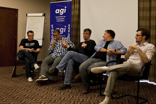
Attending any sort of conference is a tiring affair; chairing and organising one is truly exhausting. While most of the thanks on the day and afterwards were directed at me, the real thanks needs to go to my fellow organiser, Rollo Home, with the support of Chris Holcroft and Claire Huppertz, all of whom had their hands more than full with GeoCommunity starting the very next day after W3G.

As chair, I gave the opening introduction, to set the theme and tone of the day and to introduce the unconference element to those unfamiliar with the concept.

So should W3G have existed at all? The GeoWeb Track at GeoCommunity 2009 certainly showed that there was an appetite for the neo-geographic side of the Location Industry, so why not integrate W3G or the GeoWeb Track into the main GeoCommunity again? That's a difficult decision to come to ... whilst there was probably around 30% of the audience of W3G attending GeoCommunity, that still leaves 70% of the audience who were totally new to the AGI. Would they have paid the asking price of a GeoCommunity ticket? Probably not. The neo-geography side of things does tend to thrive on free or low cost events (with the notable exception of O'Reilly's Where 2.0 in Silicon Valley, which is both excellent and eye-wateringly expensive). So for this year at least, W3G served a valuable dual purpose, bringing the AGI to the attention of a community which probably didn't know it even existed and allowing a whole load of latent geographers to meet, talk, learn and network ... as well as consuming vast amounts of coffee, beer and curry. In that order.

We're already talking about repeating the success of W3G next year in some shape or form; something I definitely want to be involved in. But I would like to see the gap between the GIS heartland and the neo-geographers, which still seem to be a long way apart at times, narrowed or even closed. The AGI is eminently poised to help bring these two parts of the community together and GeoCommunity 2011 would be the ideal event to do this, making it a Geo Community in the truest sense of the word. In 2009 I questioned whether GeoCommunity would unite the two polarised worlds of geo ... the answer in 2010 is that we've take a few steps in the right direction, but we're still not there yet. Photo Credits: Paul Clarkel on Flickr.

The Union Of Subsidized Farmers, Mummy and Slayers Of Virgins - More Mapping Madness

Yanko Tsvetkov, visual artist, graphic designer and illustrator, has been at it again producing more mapping madness and cartographical curiosities. The man behind the map of Europe according to the Hungarians has produced another crop of somewhat subjective maps of Europe, where the United Kingdom comes under the headings of The Union Of Subsidized Farmers (Where I Live), Mummy (according to the USA), Slayers Of Virgins (according to France) and Enigma Code Hackers (according to Germany). Apparently.

Here's a couple of examples; Europe According To The USA ...

Europe According to the United States of America

... and Europe According To The French.

Europe According to the French

Head over to his mapping stereotypes project page for the rest. It's mapping, but not as we know it, and as Yanko aptly puts it, "a sense of humour is highly recommended".

Flight Safe Mode

As part of the security and safety announcement that gets made each time you get onto a plane these days, there's invariably a bit which goes something like this ... "all electrical equipment should be switched off during taxiing, take off and landing and all devices with a flight safe mode should have this enabled now".

This makes sense; in the case of an emergency, the airline wants you concentrating on the emergency, not your laptop or your phone. It may also be the case that the phone may in some way interfere with the flight systems. Opinion on this is divided but the former seems a more realistic option than the latter.

Where's The Map? ... Here's The Map

I'm currently at the Location Business Summit USA in the Crowne Plaza Hotel in San Jose, California where yesterday I gave a talk on "Of Data Silos, Geo-Babel and Other Geo Malaises". More about that in a later post, but one of the points I raised seemed to strike a chord with the audience ... in 2010, where's the map?

In spite of today's joyous rush to location based services and location based mobile services, the map seems to take a back seat, if it's even present at all. This point was taken up again on one of the opening panels with one of the panelists commenting that "many services don't use maps as an interface".

But there are times when the map is precisely the interface you want to use, especially when you're trying to visualize the impact of a data set on a location and serendipitously my morning trawl of my RSS feeds provided two examples of where the map is and just how effective it can be.

Facebook Places; Haven't We Been Here Before?

A week and a half ago Facebook finally launched their Places feature to a predictable media furore over location privacy, regardless of whether it's justified or not and, to location industry watchers at least, a strong sense of deja vu. Haven't we been here before?

Let's look at the key issues that seem to be getting people hot, bothered and generally up in arms.

History Is Also Written By The Man From The Council With A Tin Of White Paint

"History is written by the victors". So goes the saying attributed to Winston Churchill sometime during his reign as British Prime Minister. I'd like to offer up a corollary to that saying, which is "History is also written by the man from the council with a tin of white paint".

I should explain.

I live in what used to be the rather grandly named Municipal Borough of Twickenham. Used to be. Twickenham as a borough was created in 1926 out of the 1868 Twickenham Local Government District. In 1934 the new borough absorbed the nearby urban districts of Hampton, Hampton Wick and Teddington. But when Greater London was created in 1965, Twickenham Borough vanished overnight, becoming part of the new London Borough of Richmond Upon Thames.

Roughly Halfway Between England And France

As a race and as a society we just love our boundaries and our borders; go here, don't go here, this is yours, this is ours. We put up border controls, we tax dependent on what side of the street you live on, you need the right visa stamp in your passport to pass onto this piece of land, which looks identical to the one you're currently standing on but because of a line drawn on a map its ... different.

While lots of the animal kingdom are equally territorial, no one species has managed to invent a whole series of rules and regulations and to employe an entire bureaucracy to ensure the rules and regulations are correctly implemented and patrolled.