Posts tagged as "london"

More Location Tracking; This Time From Foursquare

Back in March of this year I wrote about deliberately tracking my journey by using Google's Latitude and unexpectedly tracking the same journey by looking at the history of my Foursquare and Gowalla check-ins.

By using the history function from Google Latitude I was able to put together a quick and dirty visualisation of the locations I'd been to but my check-in history added not only the location but also the place that was at each location.

During last week's Geo-Loco conference in San Francisco, Fred Wilson (no, not the guy from the B-52's) mentioned that you could feed your Foursquare check-in history into Google Maps and produce another quick and dirty visualisation of not only the places you'd checked into but also where those places were.
The Uncertainty Principle Of Maps Sites (And Eddie Izzard)

I should start off by saying that I don't mean mapping web sites. There's no Ovi, Yahoo!, Google or OpenStreetMap web sites in this post. No, this is a blog post about Eddie Izzard (at least slightly), Heisenberg's Uncertainty Principle (even more ephmerally), the (death of) RSS, maps and cartography (generally) and (in the main) web sites about maps and cartography.

A strange set of bedfellows you might think (you might also think I've been overdosing on LISP as there's way way too many parentheses in the first two paragraphs alone) ... but bear with me.

Eddie Izzard, in his Dress To Kill stage show ("cake or death"), was musing on the way in which people perceive history and this got me to thinking about RSS. But first, this is what he said ...

Yes, and I grew up in Europe, where the history comes from. Oh, yeah. You tear your history down, man! “30 years old, let's smash it to the floor and put a car park here!" I have seen it in stories. I saw something in a program on something in Miami, and they were saying, "We've redecorated this building to how it looked over 50 years ago!" And people were going, "No, surely not, no. No one was alive then!"

An Open Letter To Prospective Minicab Drivers

Since I started my new job, Terminal 5 at Heathrow has become close to a second home. This means I've been taking a lot of local minicabs to the airport early in the morning. The experience of frequent use of minicab services has been interesting, to say the least. With this in mind, I offer this up as a list of do's and don'ts for anyone considering plying a trade behind the wheel of a 5 year old Toyota Avensis.

Service Suspended On The London Underground (API)

If you build it they will come. Or to put it another way, sometimes demand outstrips supply. After the phenomenal success of the Transport For London Tube API, the London Datastore blog sadly notes:

Owing to overwhelming demand by apps that use the service, the London Underground feed has had to be temporarily suspended. We hope to restore the service as soon as possible but this may take some days. We will keep everyone informed of progress towards a resolution.

In the meantime, if you want to see how it does looks when the API is up and running there's a video clip of Matthew Somerville's recent Science Day hack visualisation over on my Flickr photo and video stream.

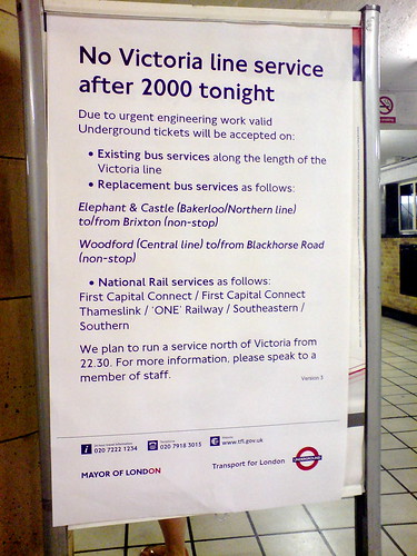
No Victoria line service after 2000 tonight Photo Credits: Martin Deutch on Flickr.

Where's My Tube Train? Ah, There's My Tube Train

Back in December of 2009, I wrote about Paul Clarke trying to solve the problem of where's my train; that there must be a definitive, raw source of real-time (train) information and that

I assert that train operators know where their assets are; it would be irresponsible if they didn't

Whilst the plethora of train operators that fragmented from the ashes of the old British Rail network haven't answered this challenge yet, Transport for London has, opening up just such data as part of the London Datastore API. In today's age of talented web mashup developers, if you release an API people will build things with it if the information is useful and interesting and that's just what Matthew Somerville of MySociety did at the recent Science Hack Day ... a (near) realtime map of the London Underground showing the movement of trains of all of the Tube lines. A screen grab wouldn't do it justice and it takes a while to load, so a video grab might help here.

When Maps and Data Collide They Produce ... Art?

Last month I wrote that a map says as much about the fears, hopes, dreams and prejudices of its target audience as it does about the relationship of places on the surface of the Earth. With the benefit of hindsight I think I was only half way right.

Sometimes a map becomes more than just a spatial representation and becomes something else.

Sometimes a data visualisation becomes more than just the underlying data and almost takes on a life of its own.

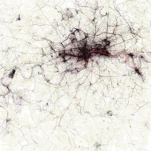
When these two things meet or collide the results can be spectacularly compelling and produce, unintentionally ... art? Look at the image below ... filigree lace work? Crochet for the deranged of mind? Silk for the sociopath? Macrame for the mad? Sadly none of the above.

The Geotaggers' World Atlas #2: London

It's instead an image from the Geotagger's World Atlas but it's still unintentionally beautiful.

Locating The Next Role; The Yahoo! Years

Looking back at my career over the last 20 or so years, it's immediately apparent that it's always been a bit geo. Geophysical seismic survey processing for natural resources (OK, mostly for oil and gas) for Digicon ... geo. Setting up operations for ERS-1, the European Space Agency's first remote sensing synthetic aperture radar satellite ... geo and rocket science. Short wave radio frequency planning to enable the BBC World Service to get transmissions into countries who would much prefer the BBC didn't broadcast there ... geo. Deploying the first geo-targeted ad system and rolling out a global place based view of the world internally and to the external developer community for Yahoo! ... totally geo. Granted, there were other roles which had no geo context whatsoever but I always seem to keep coming back to this vague and nebulous mixture of place, location, maps and geography that we term geo.

this is who I am, who are you?

Some 4 years ago (actually 3 years and 10 months but let's round up for the sake of convenience) I wasn't really looking for a new role, but the opportunity arose to come and lead and engineering team for Yahoo! Now, four years later, it's time to move onto another role, but more of that in a moment.

Curiously Cartographic Creations #3 - The Special Relationship

Odd map of the London Underground? Check. Maps of how Swedes and Hungarians see Europe? Check. Ah ... but what about how our neighbours across the Atlantic see the world? You know, the country that has a special relationship with the United Kingdom? I have just the very thing for you. Let's start with a nice simplified version of the world.

The World according to America

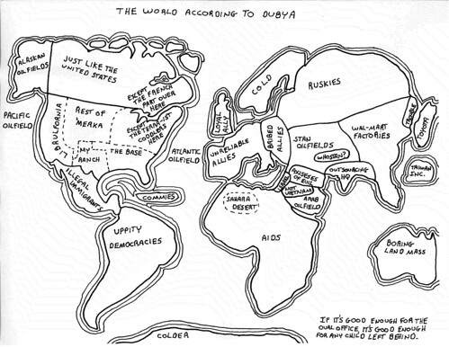
He may no longer be Mr. President but apparently George. W. Bush had a curious grasp of the world's geography.

The World According to Dubya

Keeping with the theme of President of the United States, this highly colourful view of the world comes from the mind of a Mr. Reagan. Allegedly.

The World According to Ronald Reagan

Photo Credits: irobot00 on Flickr.

Curiously Cartographic Creations #2 - Alternative Maps Of Europe

In the first of this occasional series, I looked at a curiously familiar but not quite right map of the London Underground evilly designed for tourists. In this second part of the series, it's time to cast out gaze out across the English Channel to Europe and how two of the member states see the European Union.

First there's how the Swedes see Europe; Britain is characterised by inventing soccer, inventing hooligans and beer (all three of which may be related) amongst others. The other European countries don't fare much better.

Europe according to the Swedes

Heading South and slightly East is the self styled Chosen Nation of Hungary. While the descriptions are mostly one or two words, they're not that flattering.  Britain is simply jobs, while other member states are characterised as tourist hordes, pizza, last minute hotels and beer land.

Europe according to the Hungarians

Crystal Ball Gazing Part 2 - Eddy's Sofa and The Nightmare of a Single Global Places Register

I recently contributed an article to the OpenGeoData, the blog and podcast on open maps, data and OpenStreetMap, a snippet of which is below.

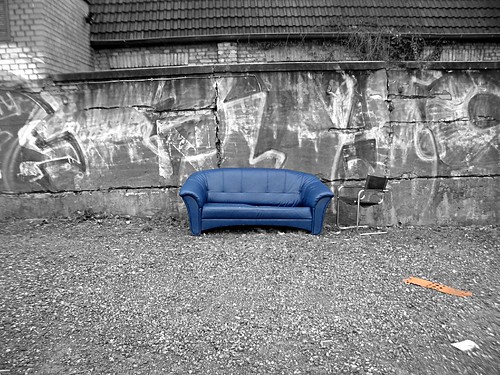
"Eddies," said Ford, "in the space-time continuum." "Ah," nodded Arthur, "is he? Is he?" "What?" said Ford. "Er, who," said Arthur, "is Eddy, then, exactly, then?" ... Why," he said, "is there a sofa in that field?" "I told you!" shouted Ford, leaping to his feet. "Eddies in the space-time continuum!" "And this is his sofa, is it?" asked Arthur, struggling to his feet and, he hoped, though not very optimistically, to his senses.

Jump onto Eddy's sofa for a moment and fast forward to a possible 2015.

After the location wars of 2010, the problems of mutually incompatible geographic identifiers have been solved with the formation of the Global Places Register. Founded by a fledgling startup on the outskirts of Bangalore, the GPR offered an open and free way for individuals and corporations to add their town, their business, their POI. All places added became part of the Global Places Translator, allowing Yahoo's WOEIDs to be transformed into OpenStreetMap Ways, into long/lat centroids, into GeoNames ids or even, for the nostalgic, Eastings and Northings.

Sofa im Regen

... the rest of the article is on the OpenGeoData blog.

Photo Credits: Hell-G on Flickr.