Posts tagged as "maps"

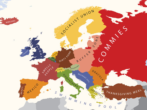
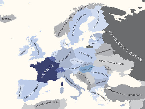
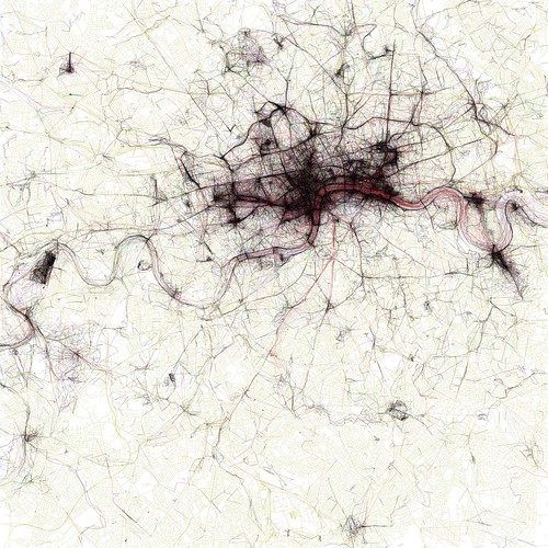
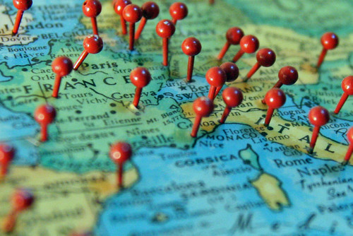
Geolocating Yourself? In Europe, You're Not Alone

Exposure 2010, the recent study by Orange and TNS, makes for some interesting reading for the location industry. Although it should be taken with a large pinch of salt from the pot labelled lies, damned lies and statistics, the study's report shows the significant increase in use of geolocation services within the mobile space.

Pushpins in a map over France and Italy

In the UK, France, Spain and Poland, geolocation services occupy the 3rd, 2nd, 1st and 2nd slots respectively for most used mobile services. While the report only breaks geolocation down into two categories, streetmap/GPS and social networks, it's not difficult to see how the perception that location is finally going mainstream is worth some merit.

Finding Inspiration And Teaching Myself Location History At The BCS Geospatial SG

With GeoBabel firmly put to rest, I was looking for inspiration when Andrew Larcombe asked me back to the British Computer Society's Geospatial Specialist Group to speak. After a week of drawing a blank, with Andrew sending gentle messages of encouragement via Twitter Direct Message (OI - GALE. TITLE. NOW!!) inspiration finally arrived from a variety of sources. Firstly there was Mashable's History of Location Technology infographic. Then there the brief history of location slides I'd used in a few of my previous talks. There was the rather fine 3D visualisation of geolocation history that Chris Osborne used at W3G and at GeoCom 2010. And then there were two questions that kept cropping up when speaking to people at conferences ... "this location stuff's only recent isn't it?" and "I can't keep up with this geo stuff, it's all moving too fast, where's it going?".

So I started to research this. I knew that location had a long history but I was taken aback to find out just how long that history was. I'd tended to think of the human race using longitude and latitude to work out their location sometime in the 1700's, about the same time as the race to make a working, reliable marine chronometer. It came as a bit of a shock to find out that longitude and latitude were first proposed in 300 BC and were first used to locate a position on the surface of the Earth in 200 BC. Focussing on use of location, on location sharing and on LBS/LBMS and putting GIS to one side I came up with A (Mostly) Complete & (Mostly) Accurate History Of Location (Abridged).

The Plains Of Awkward Public Family Interactions And The Bay Of Flames

Not content with pointing out the fun you can have with tracking your location, xkcd, the webcomic of romance, sarcasm, math and language has branched out into making maps. The updated map of online communities shows the volume of daily social activity across all of the online world, and not just the high profile ones that get the press coverage.

Click through for the full size versions and loose yourself in the plains of awkward public family interactions, the Bay Of Flames and other geographical wonders.

The Union Of Subsidized Farmers, Mummy and Slayers Of Virgins - More Mapping Madness

Yanko Tsvetkov, visual artist, graphic designer and illustrator, has been at it again producing more mapping madness and cartographical curiosities. The man behind the map of Europe according to the Hungarians has produced another crop of somewhat subjective maps of Europe, where the United Kingdom comes under the headings of The Union Of Subsidized Farmers (Where I Live), Mummy (according to the USA), Slayers Of Virgins (according to France) and Enigma Code Hackers (according to Germany). Apparently.

Here's a couple of examples; Europe According To The USA ...

Europe According to the United States of America

... and Europe According To The French.

Europe According to the French

Head over to his mapping stereotypes project page for the rest. It's mapping, but not as we know it, and as Yanko aptly puts it, "a sense of humour is highly recommended".

Where's The Map? ... Here's The Map

I'm currently at the Location Business Summit USA in the Crowne Plaza Hotel in San Jose, California where yesterday I gave a talk on "Of Data Silos, Geo-Babel and Other Geo Malaises". More about that in a later post, but one of the points I raised seemed to strike a chord with the audience ... in 2010, where's the map?

In spite of today's joyous rush to location based services and location based mobile services, the map seems to take a back seat, if it's even present at all. This point was taken up again on one of the opening panels with one of the panelists commenting that "many services don't use maps as an interface".

But there are times when the map is precisely the interface you want to use, especially when you're trying to visualize the impact of a data set on a location and serendipitously my morning trawl of my RSS feeds provided two examples of where the map is and just how effective it can be.

The Uncertainty Principle Of Maps Sites (And Eddie Izzard)

I should start off by saying that I don't mean mapping web sites. There's no Ovi, Yahoo!, Google or OpenStreetMap web sites in this post. No, this is a blog post about Eddie Izzard (at least slightly), Heisenberg's Uncertainty Principle (even more ephmerally), the (death of) RSS, maps and cartography (generally) and (in the main) web sites about maps and cartography.

A strange set of bedfellows you might think (you might also think I've been overdosing on LISP as there's way way too many parentheses in the first two paragraphs alone) ... but bear with me.

Eddie Izzard, in his Dress To Kill stage show ("cake or death"), was musing on the way in which people perceive history and this got me to thinking about RSS. But first, this is what he said ...

Yes, and I grew up in Europe, where the history comes from. Oh, yeah. You tear your history down, man! “30 years old, let's smash it to the floor and put a car park here!" I have seen it in stories. I saw something in a program on something in Miami, and they were saying, "We've redecorated this building to how it looked over 50 years ago!" And people were going, "No, surely not, no. No one was alive then!"

Two Weeks In; Of Dog Food, Mobile Handsets and Finnish Doors

Two weeks into the Nokia and Ovi experience and I can finally pause and catch my breath. It's been an intense two weeks and asking me what my impressions are of Nokia are akin to putting someone at the top of a very large, very steep and very fast roller coaster, watching them plummet down and then, before they're even out of their seat, asking them to comment on what the scenery was like. So I won't even try to comment on the scenery and will instead merely record the four things that have stuck in my mind.

I've been busy. I've been very busy. I've also been at home for all of two days in the last two weeks and whilst video chatting with my family over Skype is better than a plain old fashioned voice call it's no substitute for being at home more; but things will settle down into a more manageable routine over the coming weeks. Being busy has meant that I've kept my head down and tried to assimilate all the new information with which I'm being bombarded, a fact that's not gone unnoticed by Chris Osborne ... "severe drop off in @vicchi's bloggage and tweetage levels, means that maybe, just maybe, he is actually doing some work these days". Quite.

When Maps and Data Collide They Produce ... Art?

Last month I wrote that a map says as much about the fears, hopes, dreams and prejudices of its target audience as it does about the relationship of places on the surface of the Earth. With the benefit of hindsight I think I was only half way right.

Sometimes a map becomes more than just a spatial representation and becomes something else.

Sometimes a data visualisation becomes more than just the underlying data and almost takes on a life of its own.

When these two things meet or collide the results can be spectacularly compelling and produce, unintentionally ... art? Look at the image below ... filigree lace work? Crochet for the deranged of mind? Silk for the sociopath? Macrame for the mad? Sadly none of the above.

The Geotaggers' World Atlas #2: London

It's instead an image from the Geotagger's World Atlas but it's still unintentionally beautiful.

Curiously Cartographic Creations #2 - Alternative Maps Of Europe

In the first of this occasional series, I looked at a curiously familiar but not quite right map of the London Underground evilly designed for tourists. In this second part of the series, it's time to cast out gaze out across the English Channel to Europe and how two of the member states see the European Union.

First there's how the Swedes see Europe; Britain is characterised by inventing soccer, inventing hooligans and beer (all three of which may be related) amongst others. The other European countries don't fare much better.

Europe according to the Swedes

Heading South and slightly East is the self styled Chosen Nation of Hungary. While the descriptions are mostly one or two words, they're not that flattering.  Britain is simply jobs, while other member states are characterised as tourist hordes, pizza, last minute hotels and beer land.

Europe according to the Hungarians

For The Cartographer In You: A London Maps Meetup

It may have escaped your notice but London is pretty much map mad at the moment. If it's not documentaries on the BBC it's exhibitions of maps at the British Library.

Which seems an apt and fitting time to organise an ad-hoc, impromptu, totally unofficial gathering of latent geographers, geo-wonks, map-nerds, professional cartographers and anyone else who likes maps.

Fully intending to use the week off that I have between leaving my role in the Geo Technologies group of Yahoo! and starting my role as [redacted] with [redacted] in [redacted], I'm going to be going to the Magnificent Maps: Power, Propaganda and Art exhibition at the British Library in the afternoon of Wednesday 2nd. June 2010, followed by a few geobeers in a local hostelry and a cheeky curry afterwards.